Huger in Berkeley County, South Carolina — The American South (South Atlantic)
Quinby Bridge & Shubrick’s Plantation: The Disastrous “Raid of the Dog Days”
Inscription.
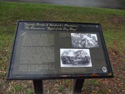
In the summer of 1781, with the British hold on the interior of South Carolina significantly weakened, Continental commander Maj. Gen. Nathaniel Greene sent Brig. Gen. Thomas Sumter, with Brig. Gen. Francis Marion and Lt. Col. Henry “Light Horse Harry” Lee, to force the British to abandon the area around Charleston and retreat into the city. As Sumter led a force of nearly a thousand men from Orangeburg, British Col. James Coates evacuated the post at Monck’s Corner and began moving his troops toward the safety of Charleston.
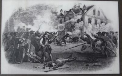
On July 17, 1781 near Quinby Bridge, Lee’s cavalry captured Coates’s rear guard and baggage caravan. A portion of Lee’s riders crossed the bridge and clashed with the British infantry ~ loosening so many planks in the process that the rest of Lee’s and Marion’s forces had to march upstream and cross Quinby Creek at a ford. By that time, the British had taken up a strong position in the main house, outbuildings and slave quarters of Shubrick’s Plantation. Against the advice of Marion and Lee, Sumter ordered an assault that quickly turned into a costly stalemate. Marion’s Brigade alone reported eight or nine killed and eighteen wounded.
Accustomed to conservative tactics that did not unnecessarily risk their lives, many of Marion’s men deserted after the battle, and Marion himself resolved never again to fight under Sumter.
Erected 2012 by Francis Marion Trail Commission of Francis Marion University.
Topics and series. This historical marker is listed in this topic list: War, US Revolutionary. In addition, it is included in the Francis Marion Trail series list. A significant historical month for this entry is July 1986.
Location. 33° 5.671′ N, 79° 48.435′ W. Marker is in Huger, South Carolina, in Berkeley County. Marker is on Cainhoy Road, on the right when traveling south. Touch for map. Marker is in this post office area: Huger SC 29450, United States of America. Touch for directions.
Other nearby markers. At least 8 other markers are within 10 miles of this marker, measured as the crow flies. Quenby Bridge (within shouting distance of this marker); Silk Hope Plantation (approx. 1.4 miles away); Pompion Hill Chapel (approx. 1.9 miles away); Brabant Plantation (approx. 5.8 miles away); Strawberry Chapel (approx. 7.3 miles away); Mepkin Plantation (approx. 8.1 miles away); St. Thomas Church (approx. 9.7 miles away); Francis Marion (approx. 10 miles away). Touch for a list and map of all markers in Huger.

Photographed By Anna Inbody, March 24, 2012
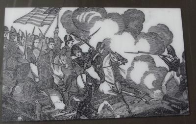
4. Drawing on the Marker
Gen. Thomas Sumter’s order to assault the strong British position at Shubrick’s Plantation cost dozens of casualties on both sides. Sumter’s brashness contrasted with Marion’s reputation for conservatism. As James Jenkins of Britton’s Neck, then a teenage militiamen, wrote of Marion: “He loved his men, and would not expose them where there was no hope.”
Credits. This page was last revised on June 16, 2016. It was originally submitted on March 25, 2012, by Anna Inbody of Columbia, South Carolina. This page has been viewed 3,033 times since then and 252 times this year. Photos: 1, 2, 3, 4. submitted on March 25, 2012, by Anna Inbody of Columbia, South Carolina. • Bill Pfingsten was the editor who published this page.


