Fairfax in Kansas City in Wyandotte County, Kansas — The American Midwest (Upper Plains)
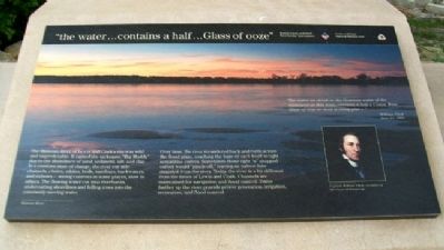
"the water…contains a half…Glass of ooze"
Inscription.
"The water we drink or the Common water of the missourie at this time, contains a half a Comm Wine Glass of ooze or mud to every pint-"
William Clark
June 21, 1804
The Missouri River of Lewis and Clark's era was wild and unpredictable. It earned the nickname "Big Muddy" due to the abundance of sand, sediment, silt, and clay. In a constant state of change, the river cut side channels, chutes, eddies, boils, sandbars, backwaters, and oxbows - strong currents in some places, slow in others. The flowing water cut into riverbanks, undercutting shorelines and felling trees into the constantly moving water.
Over time, the river meandered back and forth across the flood plain, touching the base of each bluff in tight serpantine [sic] curves. Sometimes these tight "u" shapped [sic] curves would "pinch-off," leaving an oxbow lake stranded from the river. Today the river is a bit different from the times of Lewis and Clark. Channels are maintained for navigation and flood control. Dams further up the river provide power generation, irrigation, recreation, and flood control.
Erected 2004 by National Park Service and Kansas Lewis and Clark Bicentennial Commission.
Topics and series. This historical marker is listed in these topic lists: Exploration • Waterways & Vessels. In addition, it is included in the Lewis & Clark Expedition series list. A significant historical month for this entry is June 1895.
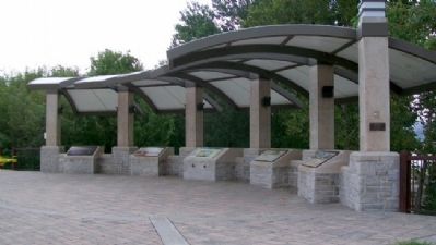
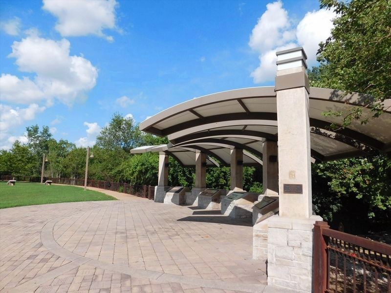
Location. 39° 6.993′ N, 94° 36.635′ W. Marker is in Kansas City, Kansas, in Wyandotte County. It is in Fairfax. Marker is at Lewis and Clark Historic Park at Kaw Point. Touch for map. Marker is at or near this postal address: 1 Fairfax Trafficway, Kansas City KS 66115, United States of America. Touch for directions.
Other nearby markers. At least 8 other markers are within walking distance of this marker. Homeland of the Kanza Indians (here, next to this marker); Encampment at Kaw's Mouth - June 26-29, 1804 (here, next to this marker); The Lewis and Clark Expedition (a few steps from this marker); "we determin to delay at this Place" (a few steps from this marker); Lewis and Clark at Kaw Point / Kaw Point (within shouting distance of this marker); Bird Woman's Trail (about 300 feet away, measured in a direct line); The Cruise-Scroggs Mansion (approx. half a mile away); Commissioner Thomas F. Lally (approx. half a mile away). Touch for a list and map of all markers in Kansas City.
Also see . . .
1. Lewis and Clark at Kaw Point. Friends of Kaw Point Park website entry (Submitted on March 27, 2012, by William Fischer, Jr. of Scranton, Pennsylvania.)
2. Lewis and Clark National Historic Trail. National Park Service website entry (Submitted on March 27, 2012, by William Fischer, Jr. of Scranton, Pennsylvania.)
3. The Journals of the Lewis and Clark Expedition. Website homepage (Submitted on March 27, 2012, by William Fischer, Jr. of Scranton, Pennsylvania.)
Credits. This page was last revised on February 10, 2023. It was originally submitted on March 27, 2012, by William Fischer, Jr. of Scranton, Pennsylvania. This page has been viewed 554 times since then and 11 times this year. Photos: 1, 2. submitted on March 27, 2012, by William Fischer, Jr. of Scranton, Pennsylvania. 3. submitted on April 6, 2022, by Adam Margolis of Mission Viejo, California.


