Palo Alto in Santa Clara County, California — The American West (Pacific Coastal)
Site of Juana Briones de Miranda Home on Rancho La Purisima Concepcion
Inscription.
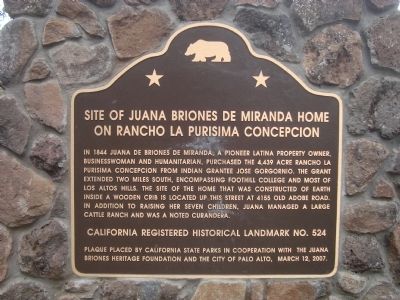
In 1844 Juana de Briones de Miranda, a pioneer Latina property owner, businesswoman and humanitarian, purchased the 4,439 acre Rancho La Purisima Concepcion from Indian grantee Jose Gorgornio. The grant extended two miles south, encompassing Foothill College and most of Los Altos Hills. The site of the home that was constructed of earth inside a wooden crib is located up this street at 4155 Old Adobe Road. In addition to raising her seven children, Juana managed a large cattle ranch and was a noted curandera.
Erected 2007 by California State Parks in cooperation with Juana Briones Heritage Foundation and the City of Palo Alto. (Marker Number 524.)
Topics and series. This historical marker is listed in these topic lists: Agriculture • Hispanic Americans • Science & Medicine. In addition, it is included in the California Historical Landmarks series list. A significant historical year for this entry is 1844.
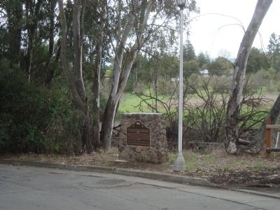
Location. 37° 23.535′ N, 122° 8.373′ W. Marker is in Palo Alto, California, in Santa Clara County. Marker is at the intersection of Old Adobe Road and Old Trace Lane on Old Adobe Road. Touch for map. Marker is at or near this postal address: 4173 Old Adobe Road, Palo Alto CA 94306, United States of America. Touch for directions.
Other nearby markers. At least 8 other markers are within 2 miles of this marker, measured as the crow flies. Juana Briones. This is her park. (approx. 1.3 miles away); Juana Briones Park (approx. 1.3 miles away); Mayfield Fire Bell (approx. 1.3 miles away); 398 and 388 Main Street (approx. 1.6 miles away); 316 Main Street (approx. 1.6 miles away); 395/397 Main Street (approx. 1.6 miles away); 306 Main Street (approx. 1.6 miles away); Los Altos Elementary School (approx. 1.6 miles away). Touch for a list and map of all markers in Palo Alto.
Also see . . .
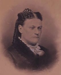
1. Juana Briones. Found SF entry (Submitted on February 5, 2021, by Larry Gertner of New York, New York.)
2. Juana Briones House. Palo Alto Stanford Heritage entry:
The adobe house was taken down in 2011. (Submitted on April 1, 2012.)
Credits. This page was last revised on May 27, 2021. It was originally submitted on March 31, 2012, by Barry Swackhamer of Brentwood, California. This page has been viewed 1,728 times since then and 84 times this year. Photos: 1, 2. submitted on March 31, 2012, by Barry Swackhamer of Brentwood, California. 3. submitted on February 5, 2021, by Larry Gertner of New York, New York. • Syd Whittle was the editor who published this page.


