Piedmont Avenue in Oakland in Alameda County, California — The American West (Pacific Coastal)
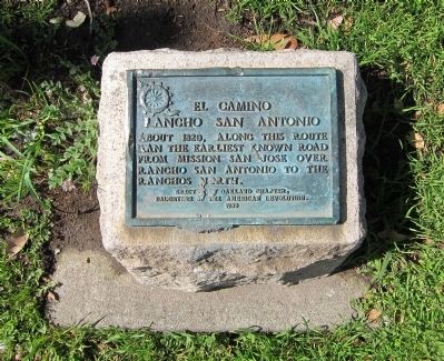
El Camino Rancho San Antonio
Erected 1939 by Daughters of the American Revolution, Oakland Chapter. (Marker Number 299.)
Topics and series. This historical marker is listed in this topic list: Roads & Vehicles. In addition, it is included in the California Historical Landmarks, the Daughters of the American Revolution, and the El Camino Real, “The King's Highway” (California) series lists. A significant historical year for this entry is 1820.
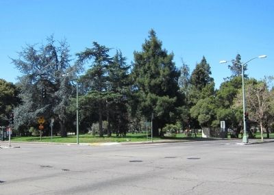
Location. 37° 49.461′ N, 122° 15.534′ W. Marker is in Oakland, California, in Alameda County. It is in Piedmont Avenue. Marker is at the intersection of West MacArthur Boulevard and Broadway, on the right when traveling east on West MacArthur Boulevard. Located in the northeast corner of Mosswood Park, at the intersection of Broadway and West MacArthur Boulevard. Touch for map. Marker is at or near this postal address: 3612 Webster St, Oakland CA 94611, United States of America. Touch for directions.
Other nearby markers. At least 8 other markers are within walking distance of this marker. Connell Motor Company (approx. 0.3 miles away); Site of Saint Mary's College (approx. 0.3 miles away); Key Route Train Station (approx. 0.4 miles away); St. Augustine's Episcopal Church (approx. 0.6 miles away); Morcom Amphitheater of Roses (approx. ¾ mile away); Here, Over Time (approx. 0.8 miles away); Antonio Bras Columns (approx. 0.9 miles away); Governor Juan Bautista Alvarado (approx. 0.9 miles away). Touch for a list and map of all markers in Oakland.
Regarding El Camino Rancho San Antonio. In 1939 this site was designated California Historical Landmark No. 299 - Camino of Rancho San Antonio. “The Camino of Rancho San Antonio ran from Mission San Jose to Fruitvale, and later to San Pablo by way of Oakland and El Cerrito. The word camino means trail, road, highway, or line of communication that is in general public or private use.”
Also see . . . History of the Peralta Family and the Rancho San Antonio. The Peralta Hacienda's history of the Peralta Family and Rancho San Antonio. No actual mention of El Camino, but it does at least provide some historical context of the development and use of the road. (Submitted on April 4, 2012.)
Credits. This page was last revised on January 24, 2024. It was originally submitted on April 4, 2012, by Andrew Ruppenstein of Lamorinda, California. This page has been viewed 1,040 times since then and 45 times this year. Photos: 1, 2. submitted on April 4, 2012, by Andrew Ruppenstein of Lamorinda, California. • Syd Whittle was the editor who published this page.

