Marker Logo HMdb.org THE HISTORICAL
MARKER DATABASE
“Bite-Size Bits of Local, National, and Global History”
Richmond Hill in Bryan County, Georgia — The American South (South Atlantic)
 

Courthouse Annex


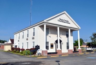
Courthouse Annex Marker image. Click for full size.
Photographed By David Seibert, April 1, 2012
1. Courthouse Annex Marker
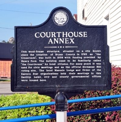
Inscription. This wood-frame structure, situated on a site known since the creation of Bryan County in 1793 as “the Crossroads”, was built in 1939 with funding provided by Henry Ford. The building came to be familiarly called “the Courthouse” by local citizens. For many years it was used for civic meetings and as the official Richmond Hill voting site. The local Masonic Lodge and Order of the Eastern Star organizations held their meetings in this facility. Later, city and county governmental offices were housed here.
 
Erected 2012 by Coastal Bryan Heritage Trail.
 
Topics. This historical marker is listed in this topic list: Notable Buildings. A significant historical year for this entry is 1793.
 
Location. 31° 56.917′ N, 81° 18.7′ W. Marker is in Richmond Hill, Georgia, in Bryan County. Marker is at the intersection of Henry Ford Avenue (Georgia Route 144) and Ellis Drive, on the right when traveling south on Henry Ford Avenue. The Courthouse Annex is approximately .05 southeast of US Highway 17, the "Crossroads" in Richmond Hill. Touch for map. Marker is at or near this postal address: 9930 Ford Avenue, Richmond Hill GA 31324, United States of America. Touch for directions.
 
Other nearby markers. At least 8 other markers are within walking distance of this marker. "Dead Town" of Hardwicke (about 400 feet away, measured in a direct line); Fort McAllister (about 400 feet away); Ways Station
Paid Advertisement
Click on the ad for more information.
Please report objectionable advertising to the Editor.
Click or scan to see
this page online
(approx. 0.3 miles away); Richmond Hill Veterans Monument (approx. 0.4 miles away); J. F. Gregory (approx. 0.4 miles away); a different marker also named Ways Station (approx. 0.4 miles away); Jack Fleming Gregory, Senior (approx. 0.4 miles away); Henry Ford at Richmond Hill (approx. 0.4 miles away). Touch for a list and map of all markers in Richmond Hill.
 
Additional keywords. Henry Ford
 
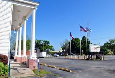
Courthouse Annex Marker image. Click for full size.
Photographed By David Seibert, April 1, 2012
2. Courthouse Annex Marker
Courthouse Annex and Marker image. Click for full size.
Photographed By David Seibert, April 1, 2012
3. Courthouse Annex and Marker
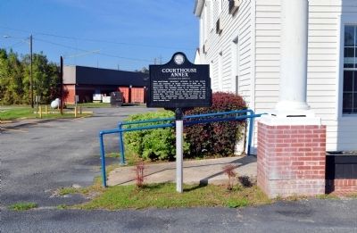
Courthouse Annex Marker image. Click for full size.
Photographed By David Seibert, April 1, 2012
4. Courthouse Annex Marker
Looking northwest from the marker: the gas station in the distance is at "The Crossroads," the intersection of US Highway 17 (Coastal Highway) and Georgia Highway 144 (Henry Ford Avenue).
 
 
Credits. This page was last revised on June 16, 2016. It was originally submitted on April 5, 2012, by David Seibert of Sandy Springs, Georgia. This page has been viewed 684 times since then and 19 times this year. Photos:   1, 2, 3, 4. submitted on April 5, 2012, by David Seibert of Sandy Springs, Georgia. • Craig Swain was the editor who published this page.
Share this page.  
Share on Tumblr
m=54142

CeraNet Cloud Computing sponsors the Historical Marker Database.
This website earns income from purchases you make after using our links to Amazon.com. We appreciate your support.
Paid Advertisement
Apr. 19, 2024