Annapolis in Anne Arundel County, Maryland — The American Northeast (Mid-Atlantic)
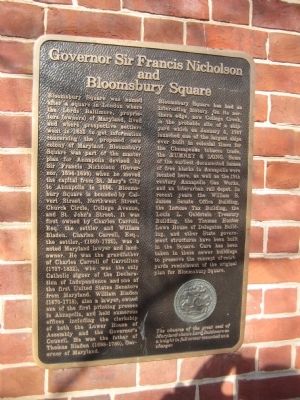
Governor Sir Francis Nicholson and Bloomsbury Square
Inscription.
Bloomsbury Square was named after a square in London where the Lords Baltimore, proprietors (owners) of Maryland, lived and where prospective settlers went in 1633 to get information concerning the proposed new colony of Maryland. Bloomsbury Square was part of the master plan for Annapolis devised by Sir Francis Nicholson (Governor, 1694-1699) when he moved the capital from St. Mary's City to Annapolis in 1695. Bloomsbury Square is bounded by Calvert Street, Northwest Street, Church Circle, College Avenue, and St. John's Street. It was first owned by Charles Carroll, Esq. the settler and William Bladen. Charles Carroll, Esq., the settler, (1660-1720), was a noted Maryland lawyer and landowner. he was the grandfather of Charles Carroll of Carrollton (1737-1832), who was the only Catholic signer of the Declaration of Independence and one of the first United States Senators from Maryland. William Bladen (1670-1718), also a lawyer, owned one of the first printing presses in Annapolis, and held numerous offices including the clerkship of both the Lower House of Assembly and the Governor's Council. He was the father of Thomas Bladen (1698-1780), Governor of Maryland.
Bloomsbury Square has had an interesting history. On its northern edge, now College Creek, is the probable site of a shipyard which on January 5, 1747 launched one of the largest ships ever built in colonial times for the Chesapeake tobacco trade, the RUMNEY & LONG. Some of the earliest documented homes of free blacks in Annapolis were located here, as well as the 19th century Annapolis Gas Works, and an interurban rail depot. In recent years the William S. James Senate Office Building, the Income Tax Building, the Louis L. Goldstein Treasury Building, the Thomas Hunter Lowe House of Delegates Building, and other State government structures have been built in the Square. Care has been taken in these newer buildings to preserve the concept of courtyards reminiscent of the original plan for Bloomsbury Square.
The obverse of the great seal of Maryland shows Lord Baltimore as a knight in full armor mounted on a charger.
Topics. This historical marker is listed in these topic lists: African Americans • Colonial Era • Settlements & Settlers. A significant historical date for this entry is January 5, 1747.
Location. 38° 58.769′ N, 76° 29.53′ W. Marker is in Annapolis, Maryland, in Anne Arundel County. Marker is at the intersection of College Avenue (Maryland Route 450) and Bladen Street, on the left when traveling east on College Avenue. Marker is attached to the corner of a state government building at the northwest corner of the intersection. Touch for map. Marker is in this post office area: Annapolis MD 21401, United States of America. Touch for directions.
Other nearby markers. At least
8 other markers are within walking distance of this marker. State House Square (a few steps from this marker); Thurgood Marshall (within shouting distance of this marker); Southgate Memorial (about 300 feet away, measured in a direct line); The Government House (about 300 feet away); White Oak (about 300 feet away); Site of the Methodist Church (about 400 feet away); Maryland State House (about 400 feet away); The Maryland Inn (about 400 feet away). Touch for a list and map of all markers in Annapolis.
Credits. This page was last revised on November 21, 2019. It was originally submitted on February 15, 2008, by F. Robby of Baltimore, Maryland. This page has been viewed 2,742 times since then and 31 times this year. Photos: 1, 2. submitted on February 15, 2008, by F. Robby of Baltimore, Maryland.

