Downtown Berkeley in Alameda County, California — The American West (Pacific Coastal)
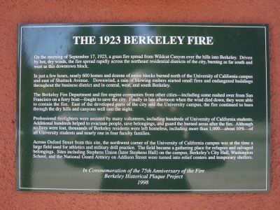
The 1923 Berkeley Fire
In just a few hours, nearly 600 homes and dozens of entire blocks burned north of the University of California campus and east of Shattuck Avenue. Downwind, a rain of blowing embers started small fires and endangered buildings throughout the business district and in central, west and south Berkeley.
The Berkeley Fire Department and fire engine companies from other cities – including some rushed over from San Francisco on a ferry boat – fought to save the city. Finally in late afternoon when the wind died down, they were able to contain the fire. East of the developed parts of the city and the University campus, the fire continued to burn through the dry hills and canyons well into the night.
Professional firefighters were assisted by many volunteers, including hundreds of University of California students. Additional hundreds helped to evacuate people, save belongings, and guard the burned areas after the fire. Although no lives were lost, thousands of Berkeley residents were left homeless, including more than 1,000 – about 10% - of all University students and nearly one in for faculty families.
Across Oxford Street from this site, the northwest corner of the University of California campus was at the time a large field used for athletics and military drill practice. The field became a gathering place for refugees and salvaged belongings. Sites including Stephens Union (later Stephens Hall) on the campus, Berkeley’s City Hall, Washington School, and the National Guard Armory on Addison Street were turned into relief centers and temporary shelters.
Erected 1998 by Berkeley Historical Plaque Project.
Topics. This historical marker is listed in this topic list: Disasters. A significant historical date for this entry is September 17, 1937.
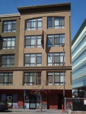
Location. 37° 52.421′ N, 122° 15.984′ W. Marker is in Berkeley, California, in Alameda County. It is in Downtown Berkeley. Marker is on Oxford Street south of Hearst Avenue, on the right when traveling south. Touch for map. Marker is at or near this postal address: 1916 Oxford Street, Berkeley CA 94704, United States of America. Touch for directions.
Other nearby markers. At least 8 other markers are within walking distance of this marker. Shattuck Square (about 800 feet away, measured in a direct line); Studio Building 1905-06 (approx. 0.2 miles away); Roos Bros. Building (approx. 0.2 miles away);
Heywood Building (approx. 0.2 miles away); F.D. Chase Building (approx. 0.2 miles away); S.H. Kress Co. Store (approx. 0.2 miles away); Francis Kittredge Shattuck Building (approx. ¼ mile away); Don Pedro Fages Expedition (approx. ¼ mile away). Touch for a list and map of all markers in Berkeley.
Also see . . . Berkeley Wildfire of 1923 Left 1,000 Students Homeless - Berkeleyan. A close brush with disaster occurred 75 years ago Thursday (Sept.17) when the Berkeley wild fire of 1923 roared down the dry north Berkeley hills toward the campus, driven by hot, dry winds. (Submitted on April 8, 2012, by Barry Swackhamer of Brentwood, California.)
Credits. This page was last revised on February 7, 2023. It was originally submitted on April 8, 2012, by Barry Swackhamer of Brentwood, California. This page has been viewed 848 times since then and 47 times this year. Photos: 1, 2. submitted on April 8, 2012, by Barry Swackhamer of Brentwood, California. • Syd Whittle was the editor who published this page.

