Utica in Oneida County, New York — The American Northeast (Mid-Atlantic)
The Great Ford of the Mohawk
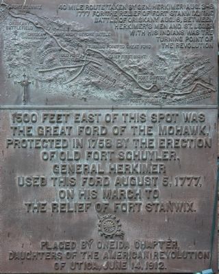
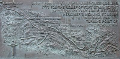
— 40 mile route taken by Gen. Herkimer Aug. 3-6, 1777 —
the Great Ford of the Mohawk
protected in 1758 by the erection
of Old Fort Schuyler.
General Herkimer
used this ford August 5, 1777,
on his march to
the relief of Fort Stanwix.
Erected 1912 by Oneida Chapter, Daughters of the American Revolution of Utica. (Marker Number 8.)
Topics and series. This historical marker is listed in these topic lists: Forts and Castles • Native Americans • War, US Revolutionary. In addition, it is included in the Daughters of the American Revolution, and the General Herkimer's 40 Mile March series lists. A significant historical year for this entry is 1777.
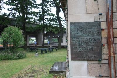
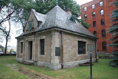
Location. 43° 6.261′ N, 75° 13.469′ W. Marker is in Utica, New York, in Oneida County. Marker is on Main Street west of Railroad Street, on the right when traveling west. This historical marker is located in a small downtown park, called the "Bagg's Square Memorial Park," that has been rendered difficult to reach by the construction of a highway bridge just to west of the marker that brings Main Street to an abrupt halt a few car lengths beyond the entrance to the park. Because the historic marker is hemmed in by the highway bridge immediately to it's west and a major railway line a short distance to it's north, the options of how to get to this historic marker are limited. I would suggest approaching this site on Broad Street, then turning north on Railroad Street and at the next intersection turning left (west) onto Main Street and proceeding west until Main Street deadends at the end of the block. The park with the historic marker is immediately to the north of where Main Street comes to an end. Touch for map. Marker is in this post office area: Utica NY 13501, United States of America. Touch for directions.
Other nearby markers. At least 8 other markers are within 2 miles of this marker, measured as the crow flies. Utica (here, next to this marker); Bagg's Tavern (here, next to this marker); The Site of Old Fort Schuyler (a few steps from this marker); a different marker also named The Site of Old Fort Schuyler (a few steps from this marker); General Herkimer Marched Past This Spot (about 600 feet away, measured in a direct line); Utica Civil War Memorial (approx. 1.1 miles away); At This Point (approx. 1.2 miles away); First Baptist Church (approx. 1.3 miles away). Touch for a list and map of all markers in Utica.
More about this marker. For anyone that is interested
in history, and enjoys viewing historic markers, visiting this marker is well worth the degree of difficulty that one must endure to reach it. There are a number of additional, significant historical markers in the park where this marker is located.
Regarding The Great Ford of the Mohawk. This historical marker is part of a series of historical markers that mark the 40 mile route taken by Gen. Herkimer Aug. 3-6, 1777 for the relief of Fort Stanwix, that resulted in the Battle of Oriskany. Some historians believe that this battle, fought between Herkimer's Patriots with his Oneida allies and St. Leger's Loyalists with their Indian allies, was the turning point of the Revolutionary War.
Related markers. Click here for a list of markers that are related to this marker. To better understand the relationship, study each marker in the order shown.
Credits. This page was last revised on June 16, 2016. It was originally submitted on April 9, 2012, by Dale K. Benington of Toledo, Ohio. This page has been viewed 750 times since then and 28 times this year. Photos: 1, 2, 3, 4. submitted on April 9, 2012, by Dale K. Benington of Toledo, Ohio.


