Enon in Chesterfield County, Virginia — The American South (Mid-Atlantic)
Point of Rocks
U.S. Military Hospital Site
— Bermuda Hundred —
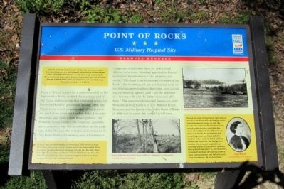
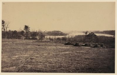
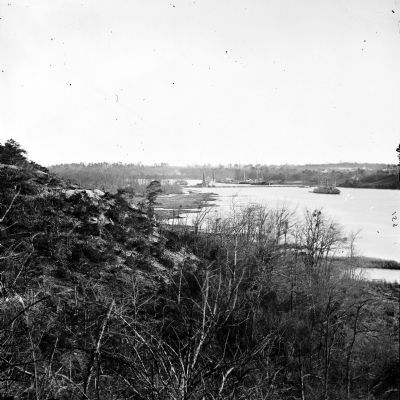
Point of Rocks, named for a sandstone cliff on the Appomattox River, marked the southern end of the Union defensive line that stretched across the Bermuda Hundred peninsula. In May 1864, the Union army seized property east of the present-day park from its owner, the Rev. John Alexander Strachan, and built a field hospital there. The Strachan house became the surgeons’ quarters, and a cemetery was also established on the property. After the war, the remains were removed to City Point National Cemetery and a freedman’s village was established there for newly freed African Americans. Strachan appealed to federal authorities for the return of his property and wrote, “This land is my homestead, the place of my birth. I have nothing left me now but my land, all my other property has been destroyed, even including my wearing apparel, and I am the husband of a delicate wife and the father of several children.” The government retained possession until Strachan proved his title in U.S. District Court. Strachan and his family returned to Point of Rocks in 1866 and he spent the rest of his life here.
(sidebar)
Early in 1864, Union Gen. Ulysses S. Grant, commander of all Federal armies, ordered advances throughout the Confederacy in the spring. On May 5, Union Gen. Benjamin F. Butler landed his Army of the James on Bermuda Hundred to operate against Richmond, Petersburg, and Confederate lines of supply. Confederate Gen. P.G.T. Beauregard countered Union advances against the Richmond and Petersburg Railroad, Drewry’s Bluff, and Petersburg. In June 1864, he effectively “bottled up” Butler’s army behind Confederate and Federal fortifications across the Bermuda Hundred peninsula for the rest of the war.
(sidebar)
In June 1864, the first attacks on Petersburg were launched from Point of Rocks over a pontoon bridge across the Appomattox River. On March 27, 1865, President Abraham Lincoln and his wife, Mary Todd Lincoln, accompanied by Gen. Ulysses S. Grant and his wife, Julia Grant, visited the Point of Rocks hospital fewer than three weeks before Lincoln was assassinated.
(sidebar)
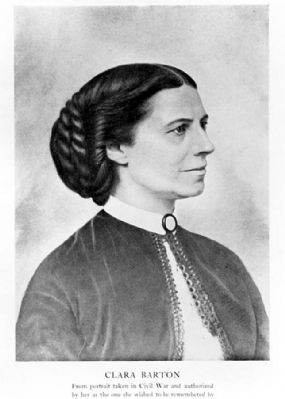
During the siege of Petersburg, Clara Barton served at the Point of Rocks hospital as the superintendent of nurses. In 1881, she founded the American Red Cross and then served as the director until 1904. She wrote of conditions here, “The mercury above a hundred, the atmosphere and everything about one black with flies, the dust rolling away in clouds as far as the eye can penetrate, the ashy ground covered with scores of hospital tents shielding nearly all conceivable maladies that soldier flesh is heir to, and stretching on beyond the miles of bristling fortifications, entrenchments, and batteries encircling Petersburg—all ready to blaze.”
Erected by Virginia Civil War Trails.
Topics and series. This historical marker is listed in this topic list: War, US Civil. In addition, it is included in the Clara Barton, and the Virginia Civil War Trails series lists. A significant historical month for this entry is March 1607.
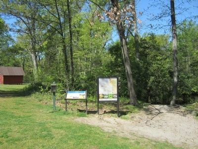
Location. 37° 19.308′ N, 77° 21.32′ W. Marker is in Enon, Virginia, in Chesterfield County. Marker can be reached from the intersection of Enon Church Road (Virginia Route 746) and Ramblewood Drive, on the left when traveling west. Located in R. Garland Dodd Park. Touch for map. Marker is at or near this postal address: 201 Enon Church Road, Chester VA 23836, United States of America. Touch for directions.
Other nearby markers. At least 8 other markers are within walking distance of this marker. Welcome to R. Garland Dodd Park at Point of Rocks (here, next to this marker); Confederate Leaders (a few steps from this marker); The Bermuda Hundred Campaign-Federal Leaders (a few steps from this marker); The Bermuda Hundred Campaign Begins (a few steps from this marker); Opening Actions of the Bermuda Hundred Campaign (approx. 0.2 miles away); Grant's Virginia Campaigns (approx. 0.2 miles away); Actions in the East 1861-1863 (approx. 0.2 miles away); Federal War Plans for 1864 (approx. 0.2 miles away). Touch for a list and map of all markers in Enon.
Also see . . .
1. Chesterfield County: Point of Rocks. National Park Service website entry (Submitted on January 9, 2024, by Larry Gertner of New York, New York.)
2. Point of Rocks. Virginia Department of Historical Resources website entry:
links to National Register of Historic Places Nomination Form (Submitted on April 9, 2012.)
3. Bermuda Hundred campaign. Essential Civil War Curriculum website entry (Submitted on January 9, 2024, by Larry Gertner of New York, New York.)
Credits. This page was last revised on January 9, 2024. It was originally submitted on April 9, 2012, by Bernard Fisher of Richmond, Virginia. This page has been viewed 1,690 times since then and 51 times this year. Photos: 1, 2, 3, 4, 5. submitted on April 9, 2012, by Bernard Fisher of Richmond, Virginia.
