Near Mettler in Kern County, California — The American West (Pacific Coastal)
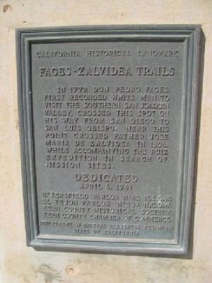
Fages-Zalvidea Trails
California Historical Landmark
Erected 1941 by Bakersfield Parlor No. 42 N.S.G.W., El Tejon Parlor No239 N.S.G.W., Kern Country Historical Society, Kern Country Chamber of Commerce, Department of Natural Resources, State of California. (Marker Number 291.)
Topics and series. This historical marker is listed in these topic lists: Colonial Era • Exploration • Hispanic Americans • Settlements & Settlers. In addition, it is included in the California Historical Landmarks, and the Native Sons/Daughters of the Golden West series lists. A significant historical year for this entry is 1772.
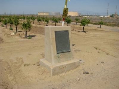
Location. 35° 3.554′ N, 119° 3.995′ W. Marker is near Mettler, California, in Kern County. Marker is on Maricopa Highway (Highway 166), on the right when traveling west. 5.5 miles West of Mettler on Highway 166. Once you pass over Interstate 5, It is just to the left of some water tanks and in front of a young orchard. Touch for map. Marker is in this post office area: Bakersfield CA 93313, United States of America. Touch for directions.
Other nearby markers. At least 8 other markers are within 17 miles of this marker, measured as the crow flies. Sinks of the Tejon (approx. 8.9 miles away); Rose Station (approx. 11.1 miles away); Sebastian Indian Reservation (approx. 11.1 miles away); Peter Lebec (approx. 16.1 miles away); Fort Tejon (approx. 16.1 miles away); Camel Trail Terminus (approx. 16.1 miles away); The Camels of Fort Tejon (approx. 16.1 miles away); Peter Lebeck (approx. 16.1 miles away).
Credits. This page was last revised on March 6, 2022. It was originally submitted on April 10, 2012, by Denise Boose of Tehachapi, California. This page has been viewed 976 times since then and 67 times this year. Photos: 1, 2. submitted on April 10, 2012, by Denise Boose of Tehachapi, California. • Syd Whittle was the editor who published this page.

