College Hill in Lynchburg, Virginia — The American South (Mid-Atlantic)
Lynchburg
Old Court House
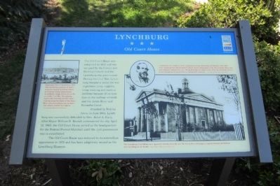
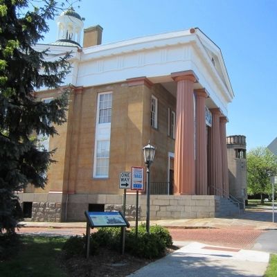
Attacked by Federal forces in June 1864, Lynchburg was successfully defended by Gen. Jubal A. Early. After Mayor William D. Branch surrendered the city April 12, 1865, the Old Court House served as the headquarters for the Federal Provost Marshall until the civil government was re-established.
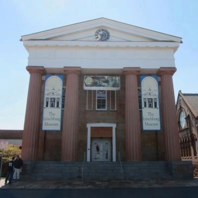
The Old Court House was restored to its antebellum appearance in 1976 and has been adaptively reused as the Lynchburg Museum.
Erected by Virginia Civil War Trails.
Topics and series. This historical marker is listed in this topic list: War, US Civil. In addition, it is included in the Virginia Civil War Trails series list. A significant historical month for this entry is April 1730.
Location. 37° 24.818′ N, 79° 8.646′ W. Marker is in Lynchburg, Virginia. It is in College Hill. Marker is at the intersection of Court Street and Ninth Street, on the left when traveling west on Court Street. Touch for map. Marker is at or near this postal address: 901 Court Street, Lynchburg VA 24504, United States of America. Touch for directions.
Other nearby markers. At least 8 other markers are within walking distance of this marker. Lynchburg History (a few steps from this marker); Lynchburg Confederate Soldiers Monument (within shouting distance of this marker); Purple Heart Memorial (within shouting distance of this marker); Samuel F. Kelso (within shouting distance of this marker); Vietnam (within shouting distance of this marker); Lucy Harrison Miller Baber (1908-1996) (within shouting distance of this marker); Mr. Elder’s Rose Garden (within shouting distance of this marker); POW★MIA (within shouting distance of this marker). Touch for a list and map of all markers in Lynchburg.
More about this marker. On the left is an image of a "Panoramic View of Lynchburg, 1855. This antebellum portrait of Lynchburg was created by Edward Beyer, an itinerant artist, and provides an authentic image of the city on the eve of the Civil War. The painting depicts the railroads and the canal running along the banks of the James River when Lynchburg was an important tobacco market in Virginia." - Lynchburg Museum Collection
On the right is a photo with the caption, "Confederate Gen. Jubal A Early commanded troops defending Lynchburg in June 1864. After repulsing Gen. David Hunter’s attack, Early campaigned in the Shenandoah Valley and was ultimately defeated by Gene Philip Sheridan at Cedar Creek. After the war Early settled in Lynchburg and is buried here in Spring Hill Cemetery." – Lynchburg Museum Collection
On the lower right is a photo with the caption, "The Lynchburg Court House as it appeared shortly after the war. Its Greek Revival design is typical of many antebellum civic buildings in the South." - Lynchburg Museum Collection
Also see . . .
1. Southside Virginia Civil War - Lynchburg. Virginia Civil War Trails (Submitted on April 13, 2012.)
2. Lynchburg Museum System. (Submitted on April 13, 2012.)
Credits. This page was last revised on February 1, 2023. It was originally submitted on April 13, 2012, by Bernard Fisher of Richmond, Virginia. This page has been viewed 667 times since then and 21 times this year. Photos: 1, 2, 3. submitted on April 13, 2012, by Bernard Fisher of Richmond, Virginia.


