Big Bend National Park in Brewster County, Texas — The American South (West South Central)
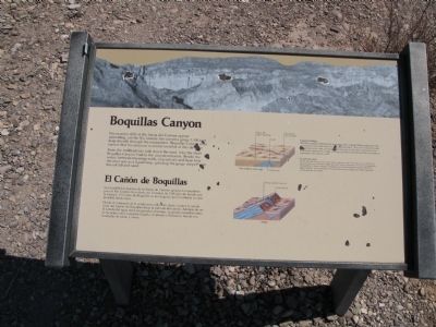
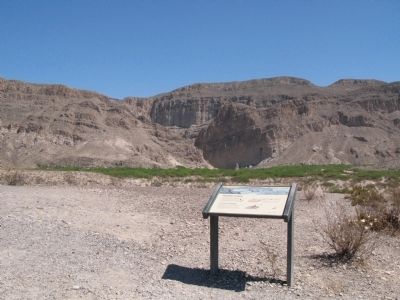
Boquillas Canyon
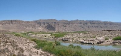
From the trailhead one mile down the road, hike the short Boquillas Canyon Trail to the canyon entrance. Beside the water, between towering walls, you can see and hear how the river acts as a liquid rasp, grinding the gorge deeper with tons of silt and sand.
Caption:
Canyon Cutting
The Rio Grande established its present course on basin-filling sediments that covered the rocks and faults we see exposed today. The river eroded through the surface layers and cut steep-walled canyons in the more resistant Lower Cretaceous limestones. Today you can see those ancient limestone formations exposed in the canyon walls.
Spanish:
El Cañón de Boquillas
Los acantilados macizos de la Sierra de Carmen aparecen inmutables pero el Río Grande ha cortado un barranco de 1500 pies de hondo por la escarpa. El Cañón de Boquillas es tan angosto que la entrada es casi invisible desde lejos.
Desde el comienzo de la senda una milla más abajo, camine la senda corta del Cañón de Boquillas hacia la entrada del cañón. Además de oir el sonido de agua entre las paredes altísimas, se puede escuchar como el río actua como raspador líquido, moliendo el barranco hondo con toneladas de cieno y arena.
Pie de dibujo:
El corte del cañón
El Río Grande formó el curso que ahora sigue en una cuenca llena de sedimentos que cubrieron las piedras y fallas que hoy vemos expuestos. El río fue desgastando la superficie y formó cañones acantilados en la más resistente piedra caliza del Bajo Cretáceo. Hoy se pueden ver ésas formaciones antiguas de caliza expuestas en las paredes del cañón.
Topics. This historical marker is listed in this topic list: Natural Features. A significant historical year for this entry is 1500.
Location. 29° 11.66′ N, 102° 55.428′ W. Marker is in Big Bend National Park, Texas, in Brewster County. Marker is on Boquillas Canyon Overlook, on the right when traveling east. Touch for map. Marker is in this post office area: Big Bend National Park TX 79834, United States of America. Touch for directions.
Other nearby markers. At least 8 other markers are within 5 miles of this marker, measured as the crow flies. River and Springs (approx. 2.4 miles away); Cool Mountains (approx. 2.4 miles away); Chihuahuan Desert (approx. 2.4 miles away); Healing Waters (approx. 4½ miles away); Reminders of the Past (approx. 4.6 miles away); Rock Art at Hot Springs (approx. 4.6 miles away); If You Build It... (approx. 4.6 miles away); Community (approx. 4.7 miles away). Touch for a list and map of all markers in Big Bend National Park.
Also see . . .
1. Wikipedia article on Boquillas, Mexico. (Submitted on April 16, 2012, by Richard Denney of Austin, Texas.)
2. Handbook of Texas Online, article on Boquillas Canyon. (Submitted on April 16, 2012, by Richard Denney of Austin, Texas.)
Credits. This page was last revised on June 16, 2016. It was originally submitted on April 16, 2012, by Richard Denney of Austin, Texas. This page has been viewed 617 times since then and 10 times this year. Photos: 1, 2, 3, 4. submitted on April 16, 2012, by Richard Denney of Austin, Texas. • Craig Swain was the editor who published this page.


