Near Spotsylvania Courthouse in Spotsylvania County, Virginia — The American South (Mid-Atlantic)
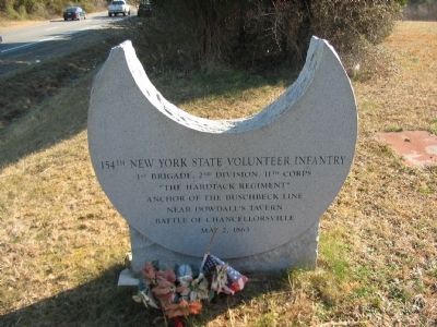
154th New York State Volunteer Infantry
"The Hardtack Regiment"
Anchor of the Buschbeck Line
Near Dowdall's Tavern
Battle of Chancellorsville
May 2, 1863
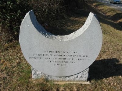
(back):
240 killed, wounded, and captured
Dedicated to the memory of the regiment
by its descendants
May 1996
Topics. This historical marker is listed in this topic list: War, US Civil. A significant historical date for this entry is May 2, 1863.
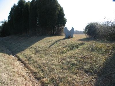
Location. 38° 18.593′ N, 77° 39.974′ W. Marker is near Spotsylvania Courthouse, Virginia, in Spotsylvania County. Marker is on Germanna Highway (State Highway 3), on the right when traveling east. Touch for map. Marker is at or near this postal address: 9600 Germanna Hwy, Spotsylvania VA 22553, United States of America. Touch for directions.
Other nearby markers. At least 8 other markers are within walking distance of this marker. Brig. Gen. E. F. Paxton, C.S.A. (approx. 0.8 miles away); Bloody Morning (approx. 0.8 miles away); Night-time Horror (approx. 0.8 miles away); Elisha Franklin Paxton (approx. 0.8 miles away); Chancellorsville Campaign (approx. 0.8 miles away); Civil War Earthworks (approx. 0.9 miles away); Jackson (approx. 0.9 miles away); The Wilderness of Spotsylvania County (approx. 0.9 miles away). Touch for a list and map of all markers in Spotsylvania Courthouse.
Regarding 154th New York State Volunteer Infantry. This is one of several markers for the Battle of Chancellorsville along the Jackson's Flank March and Attack trail. See the Jackson's Flank March and Attack Virtual Tour by Markers in the links section for a listing of related markers on the tour.
Also see . . . Jackson's Flank March and Attack Virtual Tour by Markers. This virtual tour covers the optional Jackson Flank Trail route of the driving tour and concludes at Jackson's Flank Attack (stop 8) of the driving tour, tracing the route of Jackson's march to deliver the decisive attack of the battle. (Submitted on February 17, 2008, by Craig Swain of Leesburg, Virginia.)
Credits. This page was last revised on April 6, 2024. It was originally submitted on February 17, 2008, by Craig Swain of Leesburg, Virginia. This page has been viewed 1,681 times since then and 23 times this year. Last updated on April 6, 2024, by Anonymous of Fredericksburg, Virginia. Photos: 1, 2, 3, 4. submitted on February 17, 2008, by Craig Swain of Leesburg, Virginia. • Bernard Fisher was the editor who published this page.


