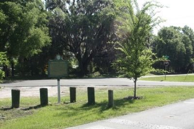
Rochelle in Alachua County, Florida — The American South (South Atlantic)
Rochelle Vicinity
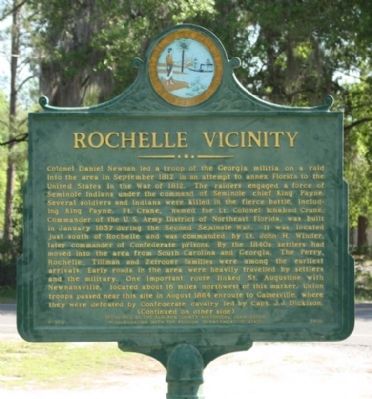
Colonel Daniel Newnan led a troop of the Georgia militia on a raid into the area in September 1812 in an attempt to annex Florida to the United States in the War of 1812. The raiders engaged a force of Seminole Indians under the command of Seminole chief King Payne. Several soldiers and Indians were killed in the fierce battle, including King Payne. Ft. Crane, named for Lt. Colonel Ichabod Crane, Commander of the U.S. Army District of Northeast Florida, was built in January 1837 during the Second Seminole War. It was located just south of Rochelle and was commanded by Lt. John H. Winder, who later served in the Mexican War. By the 1840s settlers had moved into the area from South Carolina and Georgia. The Perry, Rochelle, Tillman and Zetrouer families were among the earliest arrivals. Early roads in the area were heavily travelled by settlers and the military. One important route linked St. Augustine with Newnansville, located about 16 miles northwest of this marker. Union troops passed near this site in August 1864 enroute to Gainesville, where they were defeated by Confederate cavalry led by Capt. J.J. Dickison.
(Reverse text)
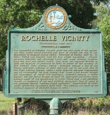
The community of Rochelle, located about one mile south of this marker, was first called Perry Junction and grew up around the site of the plantation of Madison Starke Perry, Governor of Florida 1857-61. In 1854, Perry had donated land for Oak Ridge Cemetery, located between Rochelle and Micanopy. Perry and many pioneer families from the area are buried there. The town was renamed Gruelle in 1881 and changed to Rochelle in 1884 in honor of the parents of Gov. Perry's wife, Martha Perry. Rochelle became a hub of the Florida Southern Railway in 1882 and later lay on the main line of the Plant Railway System, being a daily stopover between Jacksonville and St. Petersburg. By 1888 twenty-four trains a day passed through the community of about 100 residents. Rochelle became a citrus center, but the Great Freeze of 1894-95 destroyed the citrus crop, causing many of the inhabitants to leave. Today only a few buildings remain as reminders of the once thriving settlement. One of these is the Rochelle School (Martha Perry Institute), constructed in 1885, which served the community until 1935. The building was listed in the National Register of Historic Places in 1973.
Erected 1995 by The Alachua County Historical Commission and the Florida Department of State. (Marker Number F-353.)
Topics. This historical marker is listed in these topic lists: Agriculture • Railroads & Streetcars • Settlements & Settlers • Wars, US Indian. A significant historical month for this entry is January 1837.
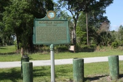
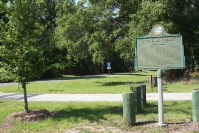
Location. 29° 35.752′ N, 82° 13.672′ W. Marker is in Rochelle, Florida, in Alachua County. Marker is at the intersection of County Road 234 and County Road 2082, on the left when traveling north on County Road 234. Touch for map. Marker is in this post office area: Gainesville FL 32641, United States of America. Touch for directions.
Other nearby markers. At least 8 other markers are within 5 miles of this marker, measured as the crow flies. Madison Starke Perry (approx. 3.1 miles away); Daniel Scott Plantation (approx. 4.3 miles away); Alachua Sink (approx. 4.6 miles away); Living Links to Florida's Past (approx. 4.6 miles away); A Cattle Economy (approx. 4.6 miles away); Trains Rumbled Overhead (approx. 4.7 miles away); Gainesville’s Only Artesian Spring (approx. 5.1 miles away); Boulware Springs Water Works Building (approx. 5.1 miles away).
Credits. This page was last revised on March 5, 2024. It was originally submitted on April 20, 2012, by Mike Stroud of Bluffton, South Carolina. This page has been viewed 1,065 times since then and 46 times this year. Photos: 1, 2, 3, 4, 5. submitted on April 20, 2012, by Mike Stroud of Bluffton, South Carolina.
