Framingham in Middlesex County, Massachusetts — The American Northeast (New England)
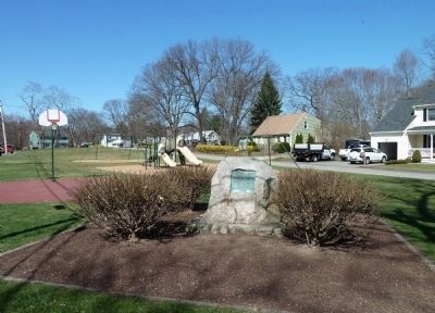
Site of Eames Massacre
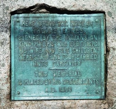
Thomas Eames,
burned by the Indians in
King Philip’s War Feb. 1, 1676.
His wife and five children
were slain and four carried
into captivity.
—
This memorial
is placed by his descendants
A.D. 1900
Erected 1900.
Topics. This historical marker is listed in these topic lists: Colonial Era • Notable Events. A significant historical month for this entry is February 1806.
Location. 42° 17.245′ N, 71° 26.14′ W. Marker is in Framingham, Massachusetts, in Middlesex County. Marker is on Chatauqua Avenue when traveling north. Marker is less than 100 feet north of the intersection of Chatauqua Avenue and Mt. Wayte Avenue. Touch for map. Marker is in this post office area: Framingham MA 01702, United States of America. Touch for directions.
Other nearby markers. At least 8 other markers are within 4 miles of this marker, measured as the crow flies. Thomas Eames (about 500 feet away, measured in a direct line); Old Burying Ground Cemetery (approx. ¾ mile away); Gen. Henry Knox Trail (approx. 0.9 miles away); Our Soldiers' Lot (approx. 1.3 miles away); Pike Haven Homestead (approx. 1.8 miles away); Ashland Town Hall (approx. 2.4 miles away); Corporal Harold E. Fay (approx. 3.7 miles away); Garden in the Woods (approx. 3.7 miles away). Touch for a list and map of all markers in Framingham.
Regarding Site of Eames Massacre. Thomas Eames was away from home on business when his family was massacred and his house burned in a raid by about a dozen Nipmuc warriors led by Netus. Eames himself died several years later.
Concerning the location of the house, in his 1847 town history (see link below) William Barry notes that “a partial depression of the surface, with the surrounding apple trees, still indicate the spot.” But in their 1999 book, King Philip’s War, Eric Schultz and Michael J. Tougias write that nothing except this marker can be seen there today.
Also see . . . History of Framingham. This 1847 book by William Barry gives a full account of the massacre on pages 24-29. (Submitted on April 26, 2012, by Roger W. Sinnott of Chelmsford, Massachusetts.)

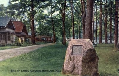
From submitter's collection, circa 1910
3. Early Postcard Showing Marker
This postcard was mailed in 1913. Montwaite, or Montwait, is the old name for this section of South Framingham, Massachusetts. In the early 20th century the area featured a popular park and campground far larger than today’s playground and bordered the Sudbury River.
Credits. This page was last revised on June 16, 2016. It was originally submitted on April 26, 2012, by Roger W. Sinnott of Chelmsford, Massachusetts. This page has been viewed 2,982 times since then and 182 times this year. Photos: 1, 2, 3. submitted on April 26, 2012, by Roger W. Sinnott of Chelmsford, Massachusetts. • Bill Pfingsten was the editor who published this page.

