Near Sharpsburg in Washington County, Maryland — The American Northeast (Mid-Atlantic)
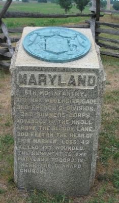
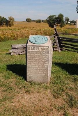
5th Maryland Infantry
5th Md Infantry
3rd Max Weber's Brigade.
3rd French's Division.
2nd Sumner's Corps.
Advanced to the knoll
above the Bloody Lane.
300 feet in the rear of
of this marker. Loss. 43
killed 123 wounded.
The monument to the
Maryland troops is
near the Dunkard
Church.
Erected 1900 by State of Maryland.
Topics. This historical marker is listed in this topic list: War, US Civil.
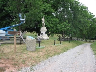
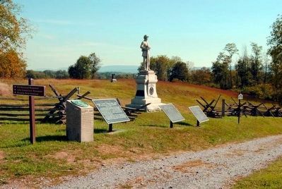
Location. 39° 28.288′ N, 77° 44.455′ W. Marker is near Sharpsburg, Maryland, in Washington County. Marker is on Richardson Avenue, on the left when traveling east. Located at the turn southeast of Richardson Avenue, next to the historical road bed of the Sunken Road (Bloody Lane). Touch for map. Marker is in this post office area: Sharpsburg MD 21782, United States of America. Touch for directions.
Other nearby markers. At least 8 other markers are within walking distance of this marker. French's Division, Second Army Corps (a few steps from this marker); Jackson's Command (a few steps from this marker); Second Army Corps (a few steps from this marker); a different marker also named Second Army Corps (a few steps from this marker); 130th Pennsylvania Volunteer Infantry (a few steps from this marker); Sixth Army Corps (within shouting distance of this marker); 1st Delaware Volunteers (within shouting distance of this marker); a different marker also named Second Army Corps (within shouting distance of this marker). Touch for a list and map of all markers in Sharpsburg.
Regarding 5th Maryland Infantry. This marker is included on the Sunken Road or Bloody Lane Virtual Tour by Markers see the Virtual tour link below to see the markers in sequence.
The regiment suffered heavily during the fighting at the Bloody Lane. It's commander, Maj. Leopold Blumenberg, was seriously wounded, and replaced by either Captain W. W. Bamberger(B Company) or Capt Faehtz (F Company). Later Capt. Salome Marsh of F Company assumed command. The regiment had served previously in the Peninsula Campaign of the Summer of 1862. After the battle of Antietam, the 5th Maryland served in the Shenandoah. Being caught up in the disaster of Second Winchester, the unit again suffered heavily. It was refitted and reformed, then served at the siege of Petersburg in 1864. At the end of the war the 5th Maryland served occupation duty in Richmond, Virginia. (Submitted on February 18, 2008, by Craig Swain of Leesburg, Virginia.)
Related markers. Click here for a list of markers that are related to this marker. Follow the 5th Maryland on the Antietam Battlefield
Also see . . . 5th Maryland Infantry Monument. National Park Service site detailing the monument. (Submitted on February 18, 2008, by Craig Swain of Leesburg, Virginia.)
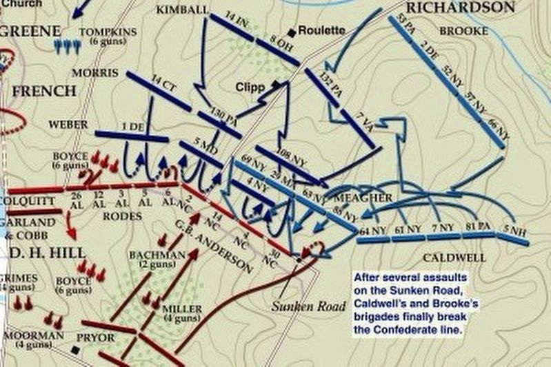
via American Battlefield Trust, unknown
5. Sunken Road or Bloody Lane Virtual Tour by Markers.
A collection of markers interpreting the action of during the Battle of Antietam around the Sunken Road.
(Submitted on February 23, 2008, by Craig Swain of Leesburg, Virginia.)
Click for more information.
(Submitted on February 23, 2008, by Craig Swain of Leesburg, Virginia.)
Click for more information.
Credits. This page was last revised on April 3, 2022. It was originally submitted on February 18, 2008, by Craig Swain of Leesburg, Virginia. This page has been viewed 1,147 times since then and 23 times this year. Photos: 1. submitted on February 18, 2008, by Craig Swain of Leesburg, Virginia. 2. submitted on September 25, 2015, by Brian Scott of Anderson, South Carolina. 3. submitted on February 18, 2008, by Craig Swain of Leesburg, Virginia. 4. submitted on September 25, 2015, by Brian Scott of Anderson, South Carolina. 5. submitted on April 3, 2022, by Larry Gertner of New York, New York.
