West Newton in Westmoreland County, Pennsylvania — The American Northeast (Mid-Atlantic)
West Newton
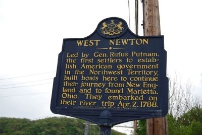
Led by Gen. Rufus Putnam, the first settlers to establish American government in the Northwest Territory, built boats here to continue their journey from New England and to found Marietta, Ohio. They embarked on their river trip April 2, 1788.
Erected 1946 by Pennsylvania Historic and Museum Commission.
Topics and series. This historical marker is listed in these topic lists: Exploration • Government & Politics. In addition, it is included in the Pennsylvania Historical and Museum Commission series list. A significant historical month for this entry is April 1886.
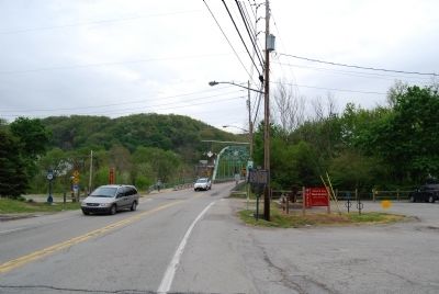
Location. 40° 12.681′ N, 79° 46.216′ W. Marker is in West Newton, Pennsylvania, in Westmoreland County. Marker is at the intersection of W Main Street (Pennsylvania Route 136) and Youghiogheny River Trail, on the right when traveling east on W Main Street. Touch for map. Marker is in this post office area: West Newton PA 15089, United States of America. Touch for directions.
Other nearby markers. At least 8 other markers are within 5 miles of this marker, measured as the crow flies. Pioneer Point Sculpture (here, next to this marker); West Newton Town Map And Directory / Trail Map And Points Of Interest (a few steps from this marker); a different marker also named West Newton (about 400 feet away, measured in a direct line); Mustard Veterans Honor Roll (approx. 2.9 miles away); George Adam Weddell (approx. 3.1 miles away); Darr Mine Disaster (approx. 4 miles away); Smithton Veterans Memorial (approx. 4.2 miles away); Smithton Service Roll (approx. 4.2 miles away). Touch for a list and map of all markers in West Newton.
Also see . . . West Newton, Pennsylvania. Wikipedia entry (Submitted on July 17, 2022, by Larry Gertner of New York, New York.)
Credits. This page was last revised on July 17, 2022. It was originally submitted on April 28, 2012, by Mike Wintermantel of Pittsburgh, Pennsylvania. This page has been viewed 647 times since then and 29 times this year. Photos: 1, 2. submitted on April 28, 2012, by Mike Wintermantel of Pittsburgh, Pennsylvania.

