Greenbrier West in Chesapeake, Virginia — The American South (Mid-Atlantic)
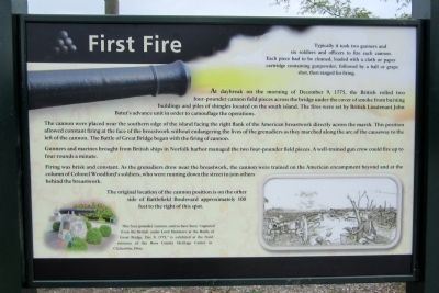
First Fire
The cannon were placed near the southern edge of the island facing the right flank of the American breastwork directly across the marsh. This position allowed constant firing at the face of the breastwork without endangering the lives of the grenadiers as they marched along the arc of the causeway to the left of the cannon. The Battle of Great Bridge began with the firing of cannon.
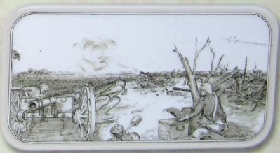
Gunners and marines brought from British ships in Norfolk harbor managed the two four-pounder field pieces. A well-trained gun crew could fire up to four rounds a minute.
Firing was brisk and constant. As the grenadiers drew near the breastwork, the cannon were trained on the American encampment beyond and at the column of Colonel Woodford’s soldiers, who were running down the street to join others behind the breastwork.
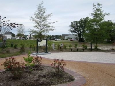
The original location of the cannon position is on the other side of Battlefield Boulevard approximately 100 feet to the right of this spot.
(sidebar)
Typically it took two gunners and six soldiers and officers to fire each cannon. Each piece had to be cleaned, loaded with a cloth or paper cartridge containing gunpowder, followed by a ball or grape shot, then ranged for firing.
Erected 2012 by Great Bridge Battlefield & Waterways History Foundation.
Topics. This historical marker is listed in this topic list: War, US Revolutionary. A significant historical date for this entry is December 9, 1775.
Location. 36° 43.322′ N, 76° 14.392′ W. Marker is in Chesapeake, Virginia. It is in Greenbrier West. Marker can be reached from the intersection of North Battlefield Boulevard (Business Virginia Route 168) and Watson Road, on the left when traveling south. Touch for map. Marker is in this post office area: Chesapeake VA 23320, United States of America. Touch for directions.
Other nearby markers. At least 8 other markers are within walking distance of this marker. Causeway Construction (a few steps from this marker); Site of the Original Causeway (a few steps from this marker); Causeways (within shouting distance of this marker); At Dawn On December 9, 1775 (within shouting distance of this marker); The Day is Our Own! (within shouting distance of this marker); Liberty to Slaves (within shouting distance of this marker); Fort Murray (within shouting distance of this marker); Father & Son Canal Builders (within shouting distance of this marker). Touch for a list and map of all markers in Chesapeake.
More about this marker. On the lower left is a photo with the caption, "This four-pounder cannon, said to have been “captured from the British under Lord Dunmore at the Battle of Great Bridge, Dec 9, 1775,” is exhibited at the front entrance of the Ross County Heritage Center in Chillicothe, Ohio."
Also see . . . Great Bridge Battlefield & Waterways History Foundation. (Submitted on April 29, 2012, by Bernard Fisher of Richmond, Virginia.)
Credits. This page was last revised on February 1, 2023. It was originally submitted on April 29, 2012, by Bernard Fisher of Richmond, Virginia. This page has been viewed 794 times since then and 11 times this year. Photos: 1, 2, 3. submitted on April 29, 2012, by Bernard Fisher of Richmond, Virginia.
Editor’s want-list for this marker. Check actual location of marker and its GPS coords. • Can you help?


