Greenbrier West in Chesapeake, Virginia — The American South (Mid-Atlantic)
Father & Son Canal Builders
The Waterways
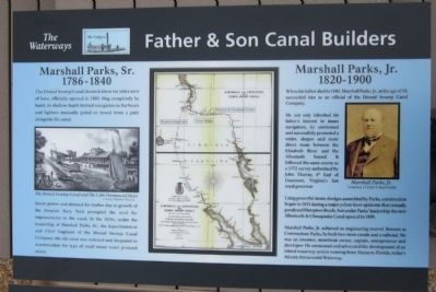
Marshall Parks, Sr.
1786-1840
The Dismal Swamp Canal, located about six miles west of here, officially opened in 1805. Dug completely by hand, its shallow depth limited navigation to flat boats and lighters manually poled or towed from a path alongside the canal.
Steam power and demand for timber due to growth of the Gosport Navy Yard prompted the need for improvements to the canal. In the 1820s, under the leadership of Marshall Parks, Sr., the Superintendent and Chief Engineer of the Dismal Swamp Canal Company, the old canal was widened and deepened to accommodate the type of small steam vessel pictured above.
Marshall Parks, Jr.
1820-1900
When his father died in 1840, Marshall Parks, Jr., at the age of 19, succeeded him as an official of the Dismal Swamp Canal Company.
He not only inherited his father’s interest in steam navigation, he envisioned and successfully promoted a wider, deeper and more direct route between the Elizabeth River and the Albemarle Sound. It followed the same course as a 1772 survey authorized by John Murray, 4th Earl of Dunmore, Virginia’s last royal governor.
Using powerful steam dredges assembled by Parks, construction began in 1855 during a major yellow fever epidemic that virtually paralyzed Hampton Roads, but under Parks’ leadership the new Albemarle & Chesapeake Canal opened in 1859.
Marshall Parks, Jr. achieved an engineering marvel. Known as Commodore Parks, he built two more canals and a railroad. He was an inventor, steamboat owner, captain, entrepreneur and developer. He envisioned and advocated the development of an inland waterway system running from Maine to Florida, today’s Atlantic Intracoastal Waterway.
Erected 2012 by Great Bridge Battlefield & Waterways History Foundation.
Topics. This historical marker is listed in these topic lists: Industry & Commerce • Waterways & Vessels. A significant historical year for this entry is 1805.
Location. 36° 43.296′ N, 76° 14.418′ W. Marker is in Chesapeake, Virginia. It is in Greenbrier West. Marker can be reached from the intersection of North Battlefield Boulevard (Business Virginia Route 168) and Locks Road, on the right when traveling south. Touch for map. Marker is in this post office area: Chesapeake VA 23320, United States of America. Touch for directions.
Other nearby markers. At least 8 other markers are within walking distance of this marker. Civil War Anchor (here, next to this marker); Under Two Flags (a few steps from this marker); Site of the Original Causeway (within shouting distance of this marker); The Day is Our Own! (within shouting distance of this marker); First Fire (within shouting distance of this marker); Causeway Construction (within shouting distance of this marker); Great Bridge Marshall Memorial (within shouting distance of this marker); Billy Flora (within shouting distance of this marker). Touch for a list and map of all markers in Chesapeake.
More about this marker. On the left is a sketch of "The Dismal Swamp Canal and The Lake Drummond Hotel" Courtesy Mariners Museum
On the right is a photo of "Marshall Parks, Jr." Courtesy of John V. Summerlin
Also see . . . Great Bridge Battlefield & Waterways History Foundation. (Submitted on April 29, 2012, by Bernard Fisher of Richmond, Virginia.)
Credits. This page was last revised on February 1, 2023. It was originally submitted on April 29, 2012, by Bernard Fisher of Richmond, Virginia. This page has been viewed 714 times since then and 19 times this year. Photo 1. submitted on April 29, 2012, by Bernard Fisher of Richmond, Virginia.
