Wellsburg in Brooke County, West Virginia — The American South (Appalachia)
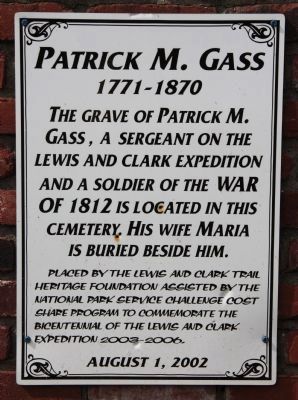
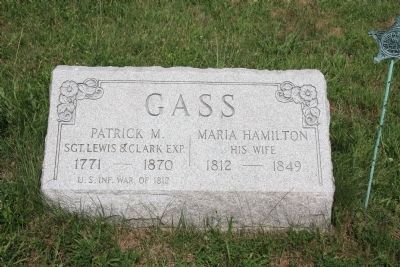
Patrick M. Gass
1771 - 1870
The grave of Patrick M. Gass, a sergeant on the Lewis and Clark Expedition and a soldier of the War of 1812 is located in this cemetery. His wife Maria is buried beside him.
Erected 2002 by The Lewis and Clark Trail Heritage Foundation, assisted by the National Park Service.
Topics and series. This historical marker is listed in these topic lists: Cemeteries & Burial Sites • Exploration • War of 1812. In addition, it is included in the Lewis & Clark Expedition series list. A significant historical year for this entry is 1812.
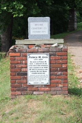
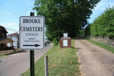
Location. 40° 17.13′ N, 80° 36.398′ W. Marker is in Wellsburg, West Virginia, in Brooke County. Marker is at the intersection of Pleasant Avenue and 23 rd Street, on the right when traveling north on Pleasant Avenue. This historic marker is affixed to a short, brick, column at the front entrance to the Brooke Cemetery, which is just off the northeast corner of the intersection of Pleasant Avenue and 23rd Street. Touch for map. Marker is in this post office area: Wellsburg WV 26070, United States of America. Touch for directions.
Other nearby markers. At least 8 other markers are within 2 miles of this marker, measured as the crow flies. Patrick Gass (about 500 feet away, measured in a direct line); Brooke County Veterans Memorial (approx. 0.4 miles away); Campbell Tarr (approx. 0.8 miles away); The Wellsburg United Methodist Church (approx. 0.9 miles away); 1849 (approx. 1.1 miles away); 1788 Wells Log House (approx. 1.2 miles away); Wellsburg's Giant Sycamore (approx. 1.2 miles away); Miller's Tavern (approx. 1.2 miles away). Touch for a list and map of all markers in Wellsburg.
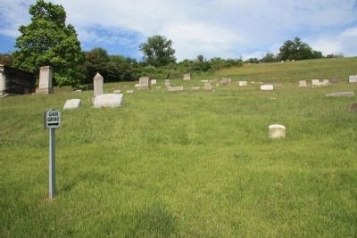
More about this marker. If you drove on State Route 2 (Commerce Street) to get to see both this historic marker and the grave site, when you reach 23rd street turn east, onto 23rd street, and proceed east for one block. Once you have reached the first intersection beyond state Route #2, look to the 3rd roadway in the north east corner of the intersection. That 3rd roadway is the front entrance to the Brooke Cemetery, and beyond the entrance is the pathway to the grave of Patrick Gass which is marked (although somewhat difficult to locate).
Regarding Patrick M. Gass. There are several markers in the community of Wellsburg that feature Patrick Gass and discuss the fact that he is buried in the Brooke Cemetery. To see his grave enter the Brooke Cemetery and proceed to the GPS location of 40°17.235'N, 080°36.293'W.
Related markers.
Click here for a list of markers that are related to this marker. To better understand the relationship, study each marker in the order shown.
Also see . . .
1. Patrick Gass. Wikipedia entry (Submitted on May 1, 2012, by Dale K. Benington of Toledo, Ohio.)
2. Gass's Journal of the Lewis and Clark Expedition. Internet Archive website entry (Submitted on November 25, 2022, by Larry Gertner of New York, New York.)
Credits. This page was last revised on November 25, 2022. It was originally submitted on April 29, 2012, by Dale K. Benington of Toledo, Ohio. This page has been viewed 881 times since then and 22 times this year. Photos: 1, 2, 3, 4, 5. submitted on May 1, 2012, by Dale K. Benington of Toledo, Ohio.
