Near East Liverpool in Columbiana County, Ohio — The American Midwest (Great Lakes)
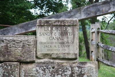
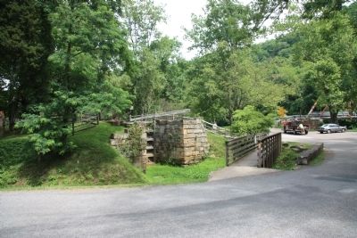
Lock 36
Inscription.
[Text on Canal Lock Stone Marker]:
Sandy & Beaver
Canal
Dedicated in memory of
Jack A. Lanam
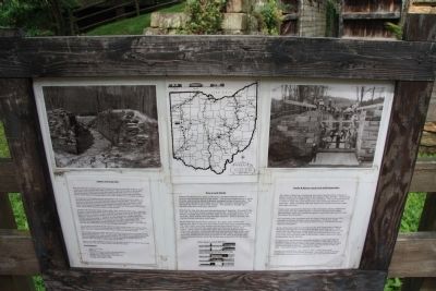
[Text on Display Panel, Page 1]:
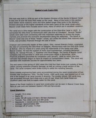
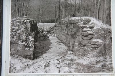
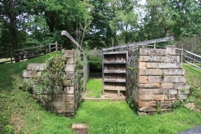
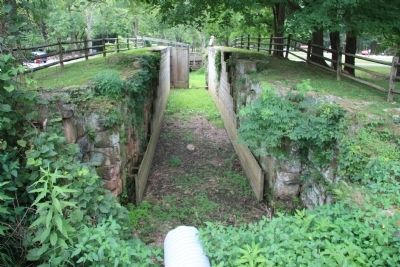
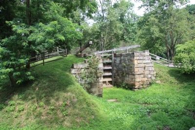
This lock was built in 1836 as part of the Eastern Division of the Sandy & Beaver Canal. It was one of over 90 locks that made up the canal. Many of the locks in this section show better stone masonry work and have lasted longer than locks in the Western Division because of the higher standards of the early years of the canal construction. Beaver Creek State Park includes seven locks, many of which are in excellent condition.
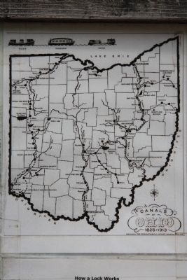
The canal era in Ohio began with the construction of the Ohio-Erie Canal in 1825. It connected the Ohio River at Portsmouth with Lake Erie in Cleveland. Several "feeder" canals were later built connecting with this important waterway to access the larger markets and promote the economic development along the waterway. The Sandy & Beaver Canal was one of these "feeder" canals, but unlike the others that received state funds, was privately financed through the sale of stock.
A lawyer and community leader of New Lisbon, Ohio, named Elderkin Potter, originated the idea of connecting the Ohio River at Glasgow, Pennsylvania with the Ohio-Erie Canal at Bolivar, Ohio by means of a canal using the watersheds of the Sandy and Little Beaver Creeks. He had the support of many local businessmen, including Benjamin Hanna, Dr. George McCook, C. Hostetter and David Beggs. The Sandy & Beaver Canal Company was incorporated in 1828 and construction began in November 1834. Financial problems prevented its completion until January, 1848 by which time the railroads had already begun to have an impact on transportation needs. The canal was operated with moderate success for approximately four years.
,br> The end came in the spring of 1852 when the Cold Run Dam broke just outside of New Lisbon causing extensive property damage, as well as ruining a large section of the canal. The canal company went broke trying to settle the resulting lawsuits.
Some notable engineering feats were accomplished during the canal construction of two tunnels near Dungannon, Ohio. The Big Tunnel, 1060 yards long, was blasted out of rock and is the longest of all canal tunnels in America. The smaller tunnel, 300 yards long, was excavated through hard shale and a vein of coal. West Fork Canal Reservoir (Guilford Lake) was built to supply water for the canal.
Some of the finest masonry in canal lock construction can be seen in Beaver Creek State Park at Lusk Lock and between Gaston's
Mill and Sprucevale.
Canal Statistics:
• Length: 73.5 miles
• Dams 30
• Locks: 90 Lift Locks (15 feet x 90 feet chambers)
• Tunnels: Two 1060 yards and 399 yards
• Aqueducts: 1 (wood) across Tuscarawas River
• Lockage: Approximately 685' • Average Lift of Locks: 7.5 feet
[Text on Display Panel, Page 2]:
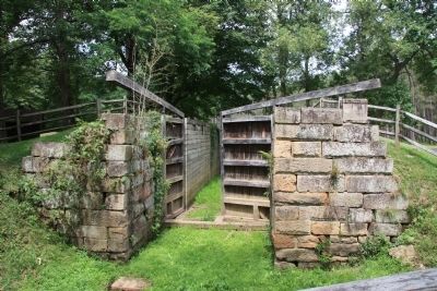
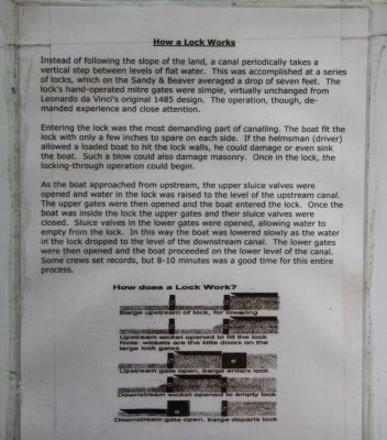
Instead of following the slope of the land, a canal periodically takes a vertical step between levels of flat water. This was accomplished at a series of locks, which on the Sandy & Beaver averaged a drop of seven feet. The lock's hand-operated mitre gates were simple, virtually unchanged from Leonardo da Vinci's original design. The operation, though, demanded experience and close attention.
Entering the lock was the most demanding part of canalling. The boat fit the lock with only a few inches to spare on each side. If the helmsman (driver) allowed a loaded boat to hit the lock walls, he could damage or even sink the boat. Such a blow could also damage masonry. Once in the lock, the locking-through operation could begin.
As the boat approached from upstream, the upper sluice valves were opened and water in the lock was raised to the level of the upstream canal. The upper gates were then opened and the boat entered
the lock. Once the boat was inside the lock the upper gates and their sluice valves were closed. Sluice valves in the lower gates were opened, allowing water to empty from the lock. In this way the boat was lowered slowly as the water in the lock dropped to the level of the downstream canal. The lower gates were then opened and the boat proceeded on the lower level of the canal. Some crews set records, but 8-10 minutes was a good time for this entire process.
[Text on Display Panel, Page 3]:
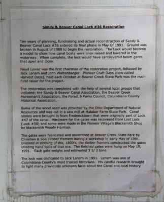
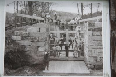
Ten years of planning, fundraising and actual reconstruction of Sandy & Beaver Canal Lock #36 entered its final phase in May of 1991. Ground was broken in August of 1988 to begin the restoration. The Lock would become a model to show how canal boats were once raised and lowered in the waterway. When complete, the lock would have cantilevered beam gates that open and close.
Floyd Lower was the first chairman of restoration project, followed by Jack Lanam and John Wattenbarger. Pioneer Craft Days (now called Harvest Days), held each October at Beaver Creek State Park was the main fund raiser for the project.
The restoration was completed with the help of several local groups that included; the Sandy & Beaver Canal Association, the Beaver Creek Horseman's Association,
the Forest & Parks Council, Columbiana County Historical Association.
Some of the wood used was provided by the Ohio Department of Natural Resources and was cut in a saw mill at Malabar Farm State Park. Canal stones were brought in from Fredericktown that were originally part of Lock #47 of the canal. Hardware for the gates was recovered from Lost Lock (Lock #50) and some were made in the Pioneer Village's Blacksmith Shop by blacksmith Woody Harman.
The gates were fabricated and assembled at Beaver Creek State Park by Christian & Son Timber framers during a workshop in early May of 1991. Dressed in clothing of the, 1800's, the timber framers constructed the gates utilizing hand tools of that era. The finished gates were hung on May 19, 1991. Each gate weighs and estimated 3 1/2 tons.
The lock was dedicated to Jack Lanam in 1991. Lanam was one of Columbiana County's most trusted historians. His careful research brought to light many previously unknown facts about the Canal and local history.
Erected 1991 by the Sandy & Beaver Canal Association, the Beaver Creek Horseman's Association, the Forest & Parks Council, Columbiana County Historical Association.
Topics. This historical marker is listed in these topic lists: Industry & Commerce • Man-Made Features • Waterways & Vessels. A significant historical year for this entry is 1836.
Location.
40° 43.628′ N, 80° 36.701′ W. Marker is near East Liverpool, Ohio, in Columbiana County. Marker is on Echo Dell Road (Local Route 929) north of Bell School Road (Local Route 1131), on the left when traveling north. This historical marker is located at Beaver Creek State Park just south of Beaver Creek, between the Gaston Mill and the 1910 steel framed bridge across Beaver Creek. Touch for map. Marker is in this post office area: East Liverpool OH 43920, United States of America. Touch for directions.
Other nearby markers. At least 8 other markers are within 7 miles of this marker, measured as the crow flies. Beaver Creek (within shouting distance of this marker); Little Beaver Creek (within shouting distance of this marker); Thomas J. Malone Bridge / Gaston's Mill (within shouting distance of this marker); Death of Pretty Boy Floyd (approx. 1˝ miles away); Dustin Huffman Memorial Overlook (approx. 2.1 miles away); Church Hill Road Bridge / Timber Covered Bridges (approx. 5.4 miles away); Riverview Cemetery (approx. 6˝ miles away); New Salem Presbyterian Church (approx. 6.8 miles away in Pennsylvania). Touch for a list and map of all markers in East Liverpool.
Also see . . .
1. Sandy and Beaver Canal. This is a link to information provided by Wikipedia, the free encyclopedia. (Submitted on May 5, 2012, by Dale K. Benington of Toledo, Ohio.)
2. Sandy and Beaver Canal. This is a link to information
provided by Ohio History Central, a product of the Ohio Historical Society. (Submitted on May 5, 2012, by Dale K. Benington of Toledo, Ohio.)
3. Sandy & Beaver Canal Locks 37 38 39 40 41 51. This is a link to information uploaded by NoRustStudios on Apr 23, 2010, on "You Tube." (Submitted on May 5, 2012, by Dale K. Benington of Toledo, Ohio.)
Credits. This page was last revised on June 16, 2016. It was originally submitted on May 1, 2012, by Dale K. Benington of Toledo, Ohio. This page has been viewed 1,350 times since then and 60 times this year. Photos: 1, 2, 3, 4, 5, 6, 7, 8, 9, 10, 11, 12, 13. submitted on May 5, 2012, by Dale K. Benington of Toledo, Ohio.
