Liberal in Seward County, Kansas — The American Midwest (Upper Plains)
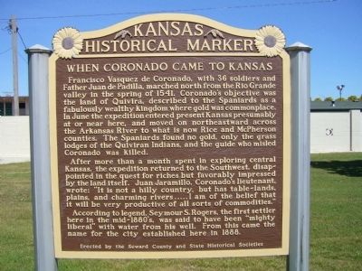
When Coronado came to Kansas
After more than a month spent in exploring central Kansas, the expedition returned to the Southwest, disappointed in the quest for riches but favorably impressed by the land itself. Juan Jaramillo, Coronado's lieutenant, wrote: "It is not a hilly country, but has table-lands, plains, and charming rivers . . . . I am of the belief that it will be very productive of all sorts of commodities."
According to legend, Seymour S. Rogers, the first settler here in the mid-1880s, was said to have been "mighty liberal" with water from his well. From this came the name for the city established here in 1888.
Erected by the Seward County and State Historical Societies. (Marker Number 114.)
Topics and series. This historical marker is listed in this topic list: Exploration. In addition, it is included in the Kansas Historical Society series list. A significant historical year for this entry is 1541.
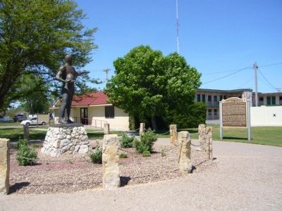
Location. 37° 2.038′ N, 100° 54.604′ W. Marker is in Liberal, Kansas, in Seward County. Marker is at the intersection of Yellow Brick Road and East Pancake Boulevard, on the right when traveling north on Yellow Brick Road. Touch for map. Marker is in this post office area: Liberal KS 67901, United States of America. Touch for directions.
Other nearby markers. At least 8 other markers are within 2 miles of this marker, measured as the crow flies. Rock Island Lines (approx. 0.7 miles away); Seward County War Dead and Missing in Action (approx. 0.8 miles away); War Memorial (approx. 0.8 miles away); Replica of the Statue of Liberty (approx. 0.9 miles away); Liberal Memorial Library (approx. 0.9 miles away); The Pioneer Mother of Kansas (approx. 0.9 miles away); International Pancake Day (approx. one mile away); Original Hand-Dug Well (approx. 1.9 miles away). Touch for a list and map of all markers in Liberal.
Credits. This page was last revised on June 16, 2016. It was originally submitted on May 11, 2012, by Bill Kirchner of Tucson, Arizona. This page has been viewed 793 times since then and 29 times this year. Photos: 1, 2, 3. submitted on May 11, 2012, by Bill Kirchner of Tucson, Arizona. • Bill Pfingsten was the editor who published this page.


