Near Meade in Meade County, Kansas — The American Midwest (Upper Plains)
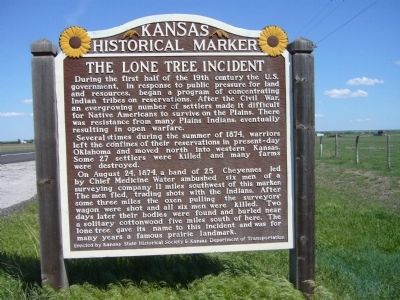
The Lone Tree Incident
Several times during the summer of 1874, warriors left the confines of their reservations in present-day Oklahoma and moved north into western Kansas. Some 27 settlers were killed and many farms were destroyed.
On August 24, 1874, a band of 25 Cheyennes led by Chief Medicine Water ambushed six men of a surveying company 11 miles southwest of this marker. The men fled, trading shots with the Indians. After three miles the oxen pulling the surveyors' wagon were shot and all six men were killed. Two days later their bodies were found and buried near a solitary cottonwood five miles south of here. The lone tree gave its name to this incident and was for many years a famous prairie landmark.
Erected by Kansas State Historical Society & Kansas Department of Transportation. (Marker Number 78.)
Topics and series. This historical marker is listed in these topic lists: Native Americans • Wars, US Indian. In addition, it is included in the Kansas Historical Society series list. A significant historical year for this entry is 1874.
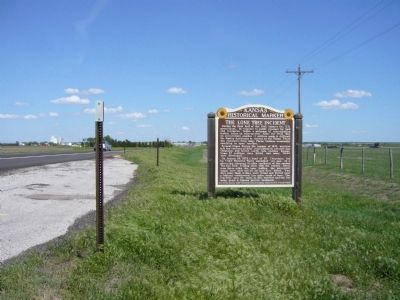
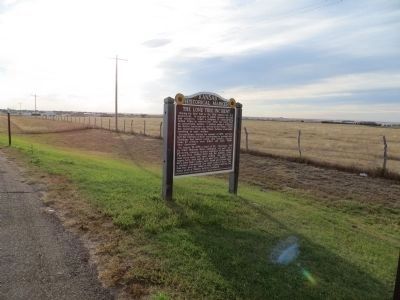
Location. 37° 17.125′ N, 100° 22.068′ W. Marker is near Meade, Kansas, in Meade County. Marker is on U.S. 54 at milepost 42.5, on the right when traveling east. Touch for map. Marker is in this post office area: Meade KS 67864, United States of America. Touch for directions.
Other nearby markers. At least 8 other markers are within 3 miles of this marker, measured as the crow flies. Meade County (approx. 1˝ miles away); Pioneer Arena Club Women and Pioneer Settlers (approx. 1˝ miles away); Veterans and War Memorials (approx. 1.6 miles away); Hoodoo Brown's Road Ranch (approx. 2.2 miles away); Jones & Plummer Trail (approx. 2.2 miles away); Graceland Cemetery (approx. 2.6 miles away); Veterans Memorial (approx. 2.7 miles away); Grace Brown (approx. 2.7 miles away). Touch for a list and map of all markers in Meade.
Credits. This page was last revised on June 16, 2016. It was originally submitted on May 11, 2012, by Bill Kirchner of Tucson, Arizona. This page has been viewed 1,886 times since then and 182 times this year. Photos: 1, 2. submitted on May 11, 2012, by Bill Kirchner of Tucson, Arizona. 3. submitted on November 11, 2014, by Bill Kirchner of Tucson, Arizona. • Bill Pfingsten was the editor who published this page.


