Near Bainbridge in Ross County, Ohio — The American Midwest (Great Lakes)
Last Battle in the Scioto Country
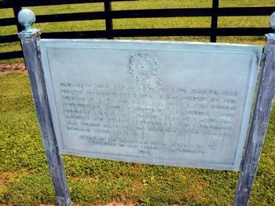
One-half mile south east of this marker was Reeves Crossing on Tod's Trace, where in the summer of 1795 the last battle in the Scioto country was fought between the whites under General Nathaniel Massie and the Shawnee Indians. The white explorers were victorious. One white man, Joshua Robinson, and several Indians were killed.
Erected 1936 by Nathaniel Massie Chapter of the Daughters of the American Revolution.
Topics and series. This historical marker is listed in these topic lists: Exploration • Settlements & Settlers • Wars, US Indian. In addition, it is included in the Daughters of the American Revolution series list. A significant historical year for this entry is 1795.
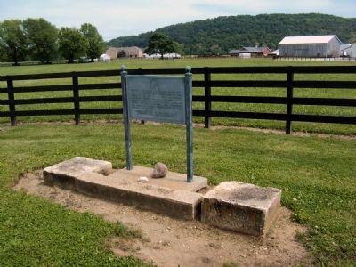
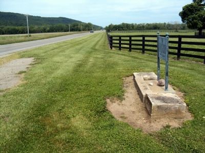
Location. 39° 14.231′ N, 83° 14.228′ W. Marker is near Bainbridge, Ohio, in Ross County. Marker is on U.S. 50, half a mile east of Local Highway 30, on the right when traveling east. The marker stands alongside the road next to the entrance to a farm, where a pull-off has been maintained. Touch for map. Marker is at or near this postal address: 6357 US 50, Bainbridge OH 45612, United States of America. Touch for directions.
Other nearby markers. At least 8 other markers are within 9 miles of this marker, measured as the crow flies. Ancient Artists (approx. 0.9 miles away); Ohio's Protector (approx. 0.9 miles away); Ceremonial Center (approx. 0.9 miles away); Anatomy of a Mound (approx. 0.9 miles away); Home of General Nathaniel Massie (approx. 3.3 miles away); PP African American Settlement / Eden Baptist Church (approx. 7.4 miles away); Salem Academy (approx. 7.9 miles away); Concord Presbyterian Church (approx. 8.2 miles away). Touch for a list and map of all markers in Bainbridge.
Also see . . . Nathaniel Massie and the Paint Creek Fight of 1795. Lower Scioto Blog entry discusses the fight at Reeves' Crossing. (Submitted on May 16, 2012, by Jamie Abel of Westerville, Ohio.)
Credits. This page was last revised on March 19, 2022. It was originally submitted on May 16, 2012, by Jamie Abel of Westerville, Ohio. This page has been viewed 975 times since then and 62 times this year. Photos: 1, 2, 3, 4, 5. submitted on May 16, 2012, by Jamie Abel of Westerville, Ohio. • Bill Pfingsten was the editor who published this page.
