Logan Township near Altoona in Blair County, Pennsylvania — The American Northeast (Mid-Atlantic)
Trackside Buildings
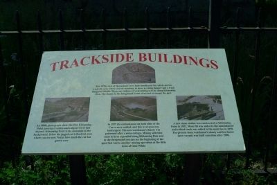
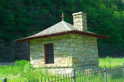
This 1870s view of Horseshoe Curve looks north past the rubble-strewn trackside area where you are standing, to show a coal hopper and a track along the hillside. These are evidence of coal mining activity along Kittanning Run. The shanty in the foreground is one of several to occupy this spot. In 1879 the embankment on both sides of the Curve were sodded, and this level area was landscaped. The new watchman's shanty was patterned after a Swiss cottage. Mining activities seem to have expanded along Kittanning Run and in the foreground you can see the beginning of the spur that ran to another mining operation at the little town of Glen White. A new stone station was constructed at Kitanning Point in 1892. More fill was added to the embankment and a third track was added to the main line in 1898. The present stone watchman's shanty and tool house (now vacant) was built sometime after 1900.
Topics. This historical marker is listed in this topic list: Railroads & Streetcars. A significant historical year for this entry is 1879.
Location. 40° 29.872′ N, 78° 29.148′ W. Marker is near Altoona, Pennsylvania, in Blair County. It is in Logan Township. Marker can be reached from Glenwhite Road / Burgoon Road. Touch for map. Marker is in this post office area: Altoona PA 16601, United States of America. Touch for directions.
Other nearby markers. At least 8 other markers are within 4 miles of this marker , measured as the crow flies. Over the Hill (here, next to this marker); The GP9 (within shouting distance of this marker); Watching The Curve (within shouting distance of this marker); Horseshoe Curve (about 400 feet away, measured in a direct line); a different marker also named Horseshoe Curve (about 400 feet away); Blair County War Mothers Memorial (approx. 3.4 miles away); Blair County Memorial Highway (approx. 3.4 miles away); Endress War Memorial (approx. 3.4 miles away). Touch for a list and map of all markers in Altoona.
Credits. This page was last revised on February 7, 2023. It was originally submitted on May 21, 2012, by Tom Fuchs of Greenbelt, Maryland. This page has been viewed 999 times since then and 80 times this year. Photos: 1, 2, 3. submitted on May 21, 2012, by Tom Fuchs of Greenbelt, Maryland.


