South Portland in Cumberland County, Maine — The American Northeast (New England)
Fort Gorges
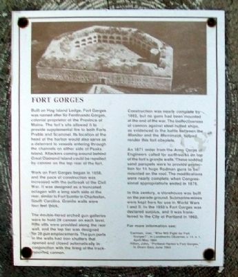
Built on Hog Island Ledge, Fort Gorges was named after Sir Ferdinando Gorges, colonial proprietor of the Province of Maine. The fort's site allowed it to provide supplemental fire to both Forts Preble and Scammel. Its location at the head of the harbor would also serve as a deterrent to vessels entering through the channels on either side of Peaks Island. Attackers coming around behind Great Diamond Island could be repelled by cannon on the top rear of the fort.
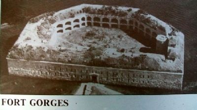
Work on Fort Gorges began in 1858, and the pace of construction was increased with the outbreak of the Civil War. It was designed as a truncated octagon with a long sixth side at the rear, similar to Fort Sumter in Charleston, South Carolina. Granite walls were four feet thick.
The double-tiered arched gun galleries were to hold 28 cannon on each level. Rifle slits were provided along the rear wall, and the top tier was designed for 39 gun emplacements. The gun ports in the walls had iron shutters that opened and closed automatically in conjunction with the firing of the track-mounted cannon.
Construction was nearly complete by 1865, but no guns had been mounted at the end of the war. The ineffectiveness of cannon against steel-hulled ships, as evidenced in the battle between the Monitor and the Merrimack, helped render this fort obsolete.
An 1871 order from the Army Corps of Engineers called for earthworks on top of the fort's granite walls. These sodded sand parapets were to provide protection for 14 huge Rodman guns to be mounted on the roof. The modifications were nearly complete when Congressional appropriations ended in 1876.
In this century, a storehouse was built on the parade ground. Submarine mines were kept here for use in World Wars I and II. In the 1950's Fort Gorges was declared surplus, and it was transferred to the City of Portland in 1960.
For more information see:
Eastman, Joel, "Who Will Fight for Fort Gorges?" in Landmarks Observer, v. 11, n. 1, April/May 1984
Hilton, John, "Portland Harbor's Fort Gorges," in Down East, June 1983
Topics. This historical marker is listed in these topic lists: Forts and Castles • War, US Civil. A significant historical month for this entry is June 1983.
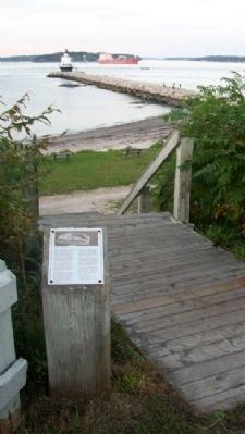
Location. 43° 38.975′ N, 70° 13.583′ W. Marker is in South Portland, Maine, in Cumberland County. Marker is along the Spring Point Shoreway Trail on the Southern Maine Community College campus, about 300 feet WSW of the causeway leading to the Spring Point Ledge Lighthouse. Touch for map. Marker is in this post office area: South Portland ME 04106, United States of America. Touch for directions.
Other nearby markers. At least 8 other markers are within walking distance of this marker. Spring Point Ledge Light (about 300 feet away, measured in a direct line); Shipbuilding (about 400 feet away); Early Settlement (about 400 feet away); Coast Artillery Corps Memorial (about 500 feet away); Coast Artillery Corps at Fort Preble (about 500 feet away); First Congregational Church of South Portland (about 700 feet away); West Yard (approx. 0.2 miles away); a different marker also named Shipbuilding (approx. 0.2 miles away). Touch for a list and map of all markers in South Portland.
Also see . . .
1. Fort Gorges, Maine. (Submitted on May 23, 2012, by William Fischer, Jr. of Scranton, Pennsylvania.)
2. History of Southern Maine Community College. (Submitted on May 23, 2012, by William Fischer, Jr. of Scranton, Pennsylvania.)
Credits. This page was last revised on February 5, 2020. It was originally submitted on May 23, 2012, by William Fischer, Jr. of Scranton, Pennsylvania. This page has been viewed 887 times since then and 27 times this year. Photos: 1, 2, 3. submitted on May 23, 2012, by William Fischer, Jr. of Scranton, Pennsylvania.


