Pawhuska in Osage County, Oklahoma — The American South (West South Central)
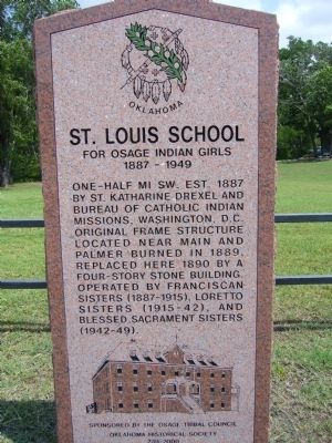
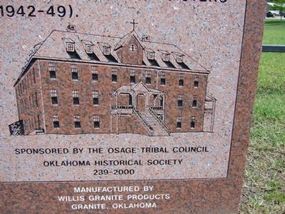
St. Louis School
For Osage Indian Girls
— 1887 – 1949 —
Erected by Osage Tribal Council & Oklahoma Historical Society.
Topics and series. This historical marker is listed in these topic lists: Education • Native Americans. In addition, it is included in the Oklahoma Historical Society series list. A significant historical year for this entry is 1887.
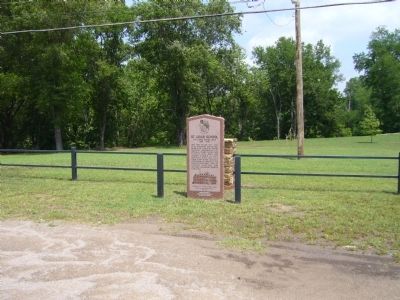
Location. 36° 39.891′ N, 96° 21.002′ W. Marker is in Pawhuska, Oklahoma, in Osage County. Marker is at the intersection of West Main Street (U.S. 60) and Farrell Avenue, on the right when traveling west on West Main Street. Touch for map. Marker is in this post office area: Pawhuska OK 74056, United States of America. Touch for directions.
Other nearby markers. At least 8 other markers are within walking distance of this marker. Blacksmith Home (approx. 0.4 miles away); "Osage in the Enemy Camp" (approx. half a mile away); Site of the First Osage Agency Building (approx. half a mile away); "Million Dollar Elm" (approx. half a mile away); Vernon Whiting (approx. 0.6 miles away); Friendship Between the Osage and the Occitan of Montauban (approx. 0.6 miles away); An Answer To Prayer (approx. 0.6 miles away); Restoring the Whiting Apartments (approx. 0.6 miles away). Touch for a list and map of all markers in Pawhuska.
Credits. This page was last revised on June 16, 2016. It was originally submitted on May 25, 2012, by Bill Kirchner of Tucson, Arizona. This page has been viewed 1,320 times since then and 95 times this year. Photos: 1, 2, 3. submitted on May 25, 2012, by Bill Kirchner of Tucson, Arizona. • Bernard Fisher was the editor who published this page.


