Near Enid in Garfield County, Oklahoma — The American South (West South Central)
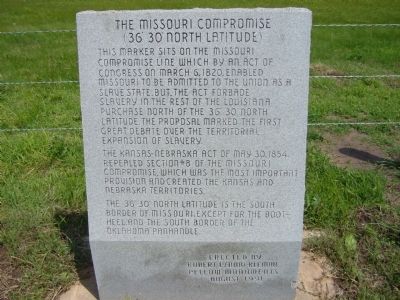
The Missouri Compromise
(36° 30' North Latitude)
The Kansas-Nebraska Act of May 30, 1854, repealed section #8 of the Missouri Compromise, which was the most important provision and created the Kansas and Nebraska Territories.
The 36° 30' North Latitude is the south border of Missouri, except for the Boot-heel, and the south border of the Oklahoma Panhandle.
Erected by Robert L. (Bob) Klemme, Pellow Monuments.
Topics. This historical marker is listed in these topic lists: African Americans • Government & Politics. A significant historical month for this entry is March 1943.
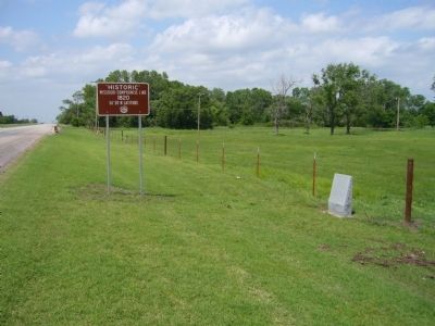
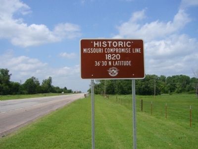
Location. 36° 29.999′ N, 97° 52.355′ W. Marker is near Enid, Oklahoma, in Garfield County. Marker is at the intersection of U.S. 60 and Cottonwood Lane, on the right when traveling north on U.S. 60. Marker is about 2 miles north of Enid. Touch for map. Marker is in this post office area: Enid OK 73701, United States of America. Touch for directions.
Other nearby markers. At least 5 other markers are within 11 miles of this marker, measured as the crow flies. The Chisholm Trail (approx. 2˝ miles away); Pioneers: Past, Present and Future (approx. 7.1 miles away); Government Springs (approx. 7.4 miles away); United States Land Office (approx. 7˝ miles away); Jesse Chisholm (approx. 10.3 miles away).
Also see . . . The Missouri Compromise - Wikipedia. (Submitted on May 30, 2012, by Bill Pfingsten of Bel Air, Maryland.)
Credits. This page was last revised on June 16, 2016. It was originally submitted on May 27, 2012, by Bill Kirchner of Tucson, Arizona. This page has been viewed 1,556 times since then and 51 times this year. Photos: 1, 2, 3. submitted on May 27, 2012, by Bill Kirchner of Tucson, Arizona. • Bill Pfingsten was the editor who published this page.


