Biddeford in York County, Maine — The American Northeast (New England)
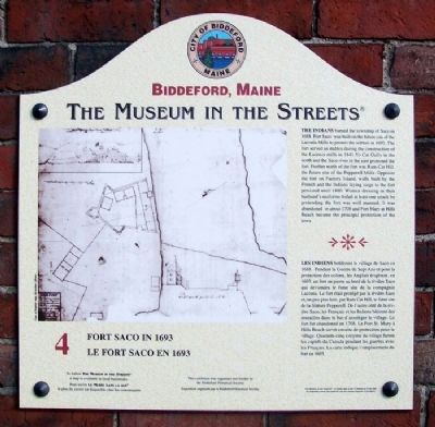
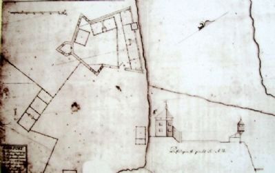
Fort Saco in 1693 / Le Fort Saco en 1693
Biddeford, Maine
— The Museum in the Streets® —
Inscription.
The Indians burned the township of Saco in 1688. Fort Saco was built on the future site of the Laconia Mills to protect the settlers in 1693. The fort served as stables during the construction of the Laconia mills in 1841. Yo Cat Gully in the north and the Saco river in the east protected the fort. Further north of the fort was Ram-Cat Hill, the future site of the Pepperell Mills. Opposite the fort on Factory Island, walls built by the French and the Indians laying siege to the fort persisted until 1800. Women dressing in their husband's uniforms foiled at least one attack by pretending the fort was well manned. It was abandoned in about 1708 and Fort Mary at Hills Beach became the principal protection of the town.
Erected 2006 by The Museum in the Streets®. (Marker Number 4.)
Topics and series. This historical marker is listed in these topic lists: Colonial Era • Forts and Castles • Settlements & Settlers • War, French and Indian. In addition, it is included in the The Museum in the Streets®: Biddeford, Maine series list. A significant historical year for this entry is 1688.
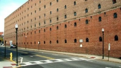
Location. 43° 29.562′ N, 70° 27.111′ W. Marker is in Biddeford, Maine, in York County. Marker is at the intersection of Main Street (Maine Route 9) and Emery Street, on the right when traveling west on Main Street. Marker is on the wall of the former Laconia Mills building. Touch for map. Marker is at or near this postal address: 22 Main St, Biddeford ME 04005, United States of America. Touch for directions.
Other nearby markers. At least 8 other markers are within walking distance of this marker. A Stone Fort (here, next to this marker); Honor Roll (within shouting distance of this marker); The James Sullivan Home / Le Résidence de James Sullivan (about 400 feet away, measured in a direct line); Alfred Street / La Rue Alfred (about 400 feet away); The Laconia Co. / La Compagnie Laconia (about 400 feet away); Biddeford's La Justice / La Justice de Biddeford (about 400 feet away); Samuel Peirson's House / La Maison Samuel Peirson (about 600 feet away); The I.O.O.F. Block / Le Bloc I.O.O.F. (about 600 feet away). Touch for a list and map of all markers in Biddeford.
Also see . . . Fort Saco, Maine. (Submitted on May 27, 2012, by William Fischer, Jr. of Scranton, Pennsylvania.)
Credits. This page was last revised on November 18, 2021. It was originally submitted on May 27, 2012, by William Fischer, Jr. of Scranton, Pennsylvania. This page has been viewed 1,208 times since then and 40 times this year. Photos: 1, 2, 3. submitted on May 27, 2012, by William Fischer, Jr. of Scranton, Pennsylvania.


