Near Richmond in Henrico County, Virginia — The American South (Mid-Atlantic)
Stuart's Ride
Passing through the Lines
— 1862 Peninsula Campaign —
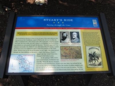
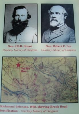
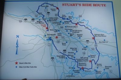
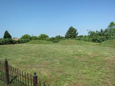
The fortifications directly in front of you are part of the outer defensive line that protected the Confederate capital of Richmond. At 5 A.M. on June 12, 1862, Confederate Gen. J.E.B. Stuart and 1,200 cavalrymen, including several who knew the local roads, left their camps on the Mordecai and Young farms just behind you and passed through the line here. The newly appointed Confederate commander, Gen. Robert E. Lee, had ordered Stuart's cavalry to probe the Federal army for weaknesses and to locate the positions of the Union flanks. Riding north on the Brook Turnpike (to your right), the column passed through the outer defenses at this point to begin what became Stuart's famed ride that circled Union Gen. George B. McClellan's army.
In the spring of 1862, before Lee's counterattack, Confederate engineer Maj. Walter H. Stevens strengthened Richmond's fortifications, largely with slave labor. Lee utilized the terrain and the strong earthworks to reduce the number of soldiers needed to protect the city at any give location and to free more men for combat. The lines were attacked and abandoned to the Federal army three times during the war.
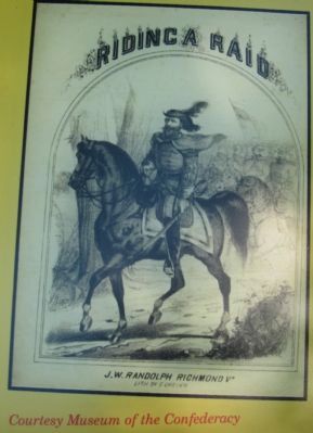
(Sidebar): Stuart's love of music was legendary. Musicians often accompanied Stuart both on the march and in camp. Reportedly, on June 12, 1862, infantrymen watching Stuart's riders leave these outer defenses asked how long they would be gone. Quoting a popular song of the time, "Kathleen Mavourneen," Stuart responded, "It may be for years, it may be forever." The rest of the column soon joined in. Songs written to glorify the exploits of Stuart's 1862 raids soon appeared, including "Jine the Cavalry" and "Riding a Raid." Richmond artist Ernest Crehen and publisher J.W. Randolph created the lithograph cover for the sheet music for the latter song.
Erected by Virginia Civil War Trails.
Topics and series. This historical marker is listed in this topic list: War, US Civil. In addition, it is included in the Virginia Civil War Trails series list. A significant historical month for this entry is May 1862.
Location. This marker has been replaced by another marker nearby.
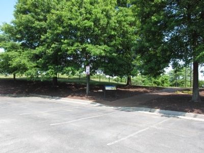
It was located near 37° 36.656′ N, 77° 27.502′ W. Marker was near Richmond, Virginia, in Henrico County. Marker could be reached from Brook Road (U.S. 1) 0.1 miles west of Brook Road, on the right when traveling south. Located in Brook Run shopping plaza. Touch for map. Marker was in this post office area: Richmond VA 23227, United States of America. Touch for directions.
Other nearby markers. At least 8 other markers are within walking distance of this location. A different marker also named Stuart's Ride (here, next to this marker); Confederate Fortifications (a few steps from this marker); The Fort Under Attack (within shouting distance of this marker); Gabriel’s Insurrection (within shouting distance of this marker); Richmond Defences (about 400 feet away, measured in a direct line); Brook Road (about 400 feet away); Outer Fortifications (about 400 feet away); Campaign of 1781 (about 400 feet away). Touch for a list and map of all markers in Richmond.
Related markers. Click here for a list of markers that are related to this marker. Markers related to J.E.B. Stuart's Ride around McClellan
Additional commentary.
1. Lee's use of slave labor
Very interesting. I have stumbled upon newspaper accounts, brief mentions, showing that the massive earth works around Richmond and Petersburg were made largely by slave labor. No one thought much of it at the time, but several newspaper articles discussed how the slaves were gathered -- slave owners who owned more than 10 slaves had to donate 10% of their able male slaves for Lee to use in the construction of the earthworks. Slave owners were to be paid 16 dollars a month, to compensate them for use of the slaves. This is really a fascinating aspect of the Civil War, since the earthworks kept Richmond and Petersburg going for years. If you have been to Fort McCallister, and walked around the earthworks, you can see how difficult it would have been to breech them. They were designed to give defenders the ability to defend at 10-20 to 1 ratio. Nothing could blow the earthworks apart. Certainly no cannon of the period could remove them. Note To Editor only visible by Contributor and editor
— Submitted August 17, 2012, by Mark Curran of Morton, Illinois.
Credits. This page was last revised on April 22, 2022. It was originally submitted on May 27, 2012, by Craig Swain of Leesburg, Virginia. This page has been viewed 1,165 times since then and 41 times this year. Photos: 1, 2, 3, 4, 5, 6. submitted on May 27, 2012, by Craig Swain of Leesburg, Virginia.
