Garthfield near Charlottesville in Albemarle County, Virginia — The American South (Mid-Atlantic)
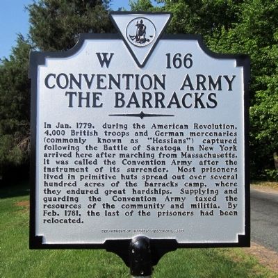
Convention Army The Barracks
Erected 2011 by Department of Historic Resources. (Marker Number W-166.)
Topics and series. This historical marker is listed in this topic list: War, US Revolutionary. In addition, it is included in the Virginia Department of Historic Resources (DHR) series list. A significant historical month for this entry is January 1779.
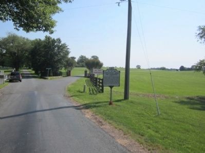
Location. 38° 5.705′ N, 78° 31.558′ W. Marker is near Charlottesville, Virginia, in Albemarle County. It is in Garthfield. Marker is on Barracks Farm Road (County Route 658) east of Garthfield Lane, on the right when traveling east. Touch for map. Marker is at or near this postal address: 740 Garthfield Ln, Charlottesville VA 22901, United States of America. Touch for directions.
Other nearby markers. At least 8 other markers are within 3 miles of this marker, measured as the crow flies. Albemarle Barracks Burial Site (approx. 0.3 miles away); The Origins of Ivy Creek Natural Area (approx. 1.8 miles away); Legacy of Hugh Carr / The Village of Hydraulic Mills (approx. 1.8 miles away); Six Miles of Trails (approx. 1.8 miles away); Old Springs (approx. 1.9 miles away); “The Albemarle 26” (approx. 2 miles away); Rio Hill 1864 Skirmish (approx. 3 miles away); Rio Hill (approx. 3 miles away). Touch for a list and map of all markers in Charlottesville.
Credits. This page was last revised on February 2, 2023. It was originally submitted on May 29, 2012, by Bernard Fisher of Richmond, Virginia. This page has been viewed 2,014 times since then and 68 times this year. Photos: 1, 2. submitted on May 29, 2012, by Bernard Fisher of Richmond, Virginia.

