Foxborough in Norfolk County, Massachusetts — The American Northeast (New England)
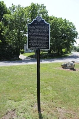
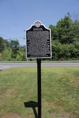
First Settler / Roads and Boundaries
The first dwelling in what would become Foxborough was erected in 1669. It was located west of nearby Wading River on a farm laid out for Captain William Hudson who was a Boston tavern keeper. Hudson never lived here, but leased the property, first to Richard George and then to John Daniell. Hudson sold his farm in 1676 to Thomas Platt who in turn leased it to Thomas Brintnall of Chelsea. In 1689, a grandson of Thomas, Samuel Brintnall Jr., became the first white child born in the future Foxborough. The old Hudson Farm was leased to Jacob Shepard of Mystic (Medford) who bought the tract outright in 1704. Former tenant Thomas Brintnall purchased land nearby in 1691 to erect a home in what he believed to be the Taunton North Purchase (a portion of which is now Mansfield). A later survey revealed he was still on this side of the line, the first settler to actually build and occupy his own home in what would become Foxborough. Following his death, his son moved the home across the line where Thomas, our unintentional first settler, thought the had built in the first place. This settlement was in the area that was set off to Wrentham in 1753 and became part of the new town of Foxborough when it was incorporated in 1778.
The road to Bristol closely followed an old Indian trail coming southwest from Dedham to Bristol (now Rhode Island)along the general lines of the present Mechanic, South and Cedar streets. At various times it was called the Road to Secunke, road to Bristol, Old country road, and the Old Post road. In 1645, John Winthrop, Jr. returned this way on foot from New London, resting near this very spot. In 1728, William Burnett, the newly appointed Governor of Massachusetts passed here with his colorful entourage. The boundary between the Massachusetts-Bay and the New-Plymouth Colonies was laid out in 1664. The section from the Angle tree in Plainville to Accord Pond in Hingham lies to the southwest. Roughly parallel to this part of Cedar street. On July 13 1670 Chief Squamaug of the Ponkapoags and Metacom (King Philip)of the Wampanoags met in the house owned by Captain William Hudson to discuss the limits of their own jurisdictions. All parties agreed upon a line that follows the present boundary between Norfolk and Bristol countries and the towns of Foxborough and Mansfield
Erected 2006 by Foxborough Historical Commission.
Topics. This historical marker is listed in these topic lists: Colonial Era • Native Americans • Settlements & Settlers. A significant historical month for this entry is July 1887.
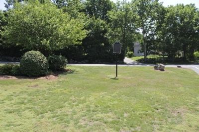
Location. 42° 1.469′ N, 71° 16.407′ W. Marker is in Foxborough, Massachusetts, in Norfolk County. Marker is at the intersection of South Street and Cedar St., in the median on South Street. Touch for map. Marker is at or near this postal address: 470 South St, Foxboro MA 02035, United States of America. Touch for directions.
Other nearby markers. At least 8 other markers are within 3 miles of this marker, measured as the crow flies. Wading River Farm (here, next to this marker); The Dorchester School Farm (approx. 1.1 miles away); The Lodge at Foxborough (approx. 2.4 miles away); Paineburgh-Foxvale (approx. 2˝ miles away); The Town Lot (approx. 2.7 miles away); Mansfield Veterans Memorial (approx. 2.8 miles away); Historic Town Hall Clock (approx. 2.8 miles away); Lowney Common (approx. 2.8 miles away). Touch for a list and map of all markers in Foxborough.
Credits. This page was last revised on November 24, 2020. It was originally submitted on May 31, 2012, by Bryan Simmons of Attleboro, Massachusetts. This page has been viewed 549 times since then and 31 times this year. Photos: 1. submitted on May 31, 2012, by Bryan Simmons of Attleboro, Massachusetts. 2. submitted on June 3, 2012, by Bryan Simmons of Attleboro, Massachusetts. 3. submitted on May 31, 2012, by Bryan Simmons of Attleboro, Massachusetts. • Bill Pfingsten was the editor who published this page.


