Near Nancy in Wayne County, Kentucky — The American South (East South Central)
Noble Ellis - Sternwheeler that Saved an Army
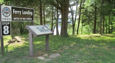
Ferry Landing
— Battle of Mill Springs —
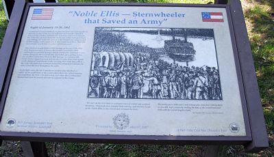
Confederate General Zollicoffer's pleas for more men and supplies to meet the strong Union force he expected went mostly unheeded. General Albert Sidney Johnston did, however, send a river steamer, the Noble Ellis, up from Nashville for his use. Laden with provisions and clothing, the Noble Ellis arrived at the Confederate camp located at Mill Springs on the south side of the Cumberland River. This little sternwheeler would later save the Confederate army.
After the hard fought Battle of Mill Springs on January 19th, 1862, near the present town of Nancy, the routed Confederates fled southward toward Mill Springs, closely pursued by victorious Union troops. Escape for the Confederates depended upon getting across the swollen Cumberland River to Mill Springs. As darkness fell, Union forces stopped pursuit and decided to make their final assault on the defeated Confederates in the morning. But while they rested, the Noble Ellis and a few rowboats ferried the exhausted Confederate army across the river throughout the night.
As daylight came, the last Confederate soldiers disembarked in safety on the south bank of the Cumberland River. Its critical mission accomplished, the Noble Ellis met a fiery end when the Confederates burned and sank the boat to prevent its capture by the Union.
A drawing on the right shows Confederate troops embarking on the sternwheeler to be ferried across the Cumberland River. Caption: "We were on the river bank in a compact mass of excited and confused humanity. Thousands were crowded there waiting, each his turn to get on the 'Noble Ellis' as she crossed and recrossed the river. The enemy just over a mile behind who, from their battery above us on a hill, kept constantly shelling the boat as she crossed back and forth with her excited fugitive loads." -- W. J. Warsham, 19th Tennessee Volunteer Infantry
Erected by Mill Springs Battlefield Association & Kentucky Humanities Council.
Topics. This historical marker is listed in this topic list: War, US Civil. A significant historical date for this entry is January 10, 1737.
Location. This marker has been replaced by another marker nearby. It was located near 36° 56.517′ N, 84° 47.176′ W. Marker was near Nancy, Kentucky, in Wayne County. Marker was at the intersection of Mill Springs Battlefield Road and Sellars Road (County Route 1523D) when traveling south on Mill Springs Battlefield Road. Marker is at a T-intersection at the end of the Mill Springs Battlefield Road. The road ends as a trail to a boat ramp on Lake Cumberland. A
pulloff is provided. This is Tour Stop #8 of the Mill Springs Battlefield Driving Tour, the last tour stop north of the Cumberland River. Touch for map. Marker was in this post office area: Nancy KY 42544, United States of America. Touch for directions.
Other nearby markers. At least 8 other markers are within walking distance of this location. The Noble Ellis Saves an Army (here, next to this marker); The Cumberland River (approx. 0.7 miles away); The Battle of Mill Springs (approx. 0.7 miles away); Home, Headquarters, Hospital (approx. ¾ mile away); Mill Springs and the Civil War (approx. ¾ mile away); Zollie's Den (approx. ¾ mile away); Beech Grove / Noble Ellis (approx. ¾ mile away); Mill Springs (approx. 0.8 miles away). Touch for a list and map of all markers in Nancy.
More about this marker. This marker was replaced by a new one named The Noble Ellis Saves an Army (see nearby markers).
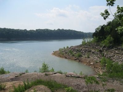
Regarding Noble Ellis - Sternwheeler that Saved an Army. A short (300') walk along a rocky trail leads to Lake Cumberland, formerly the Cumberland River.
Credits. This page was last revised on August 2, 2019. It was originally submitted on June 1, 2012, by David Graff of Halifax, Nova Scotia. This page has been viewed 718 times since then and 15 times this year. Photos: 1, 2, 3. submitted on June 1, 2012, by David Graff of Halifax, Nova Scotia. • Craig Swain was the editor who published this page.


