Westfield in Hampden County, Massachusetts — The American Northeast (New England)
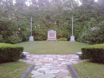
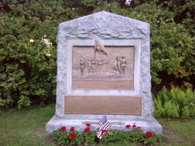
The 104th U.S. Infantry
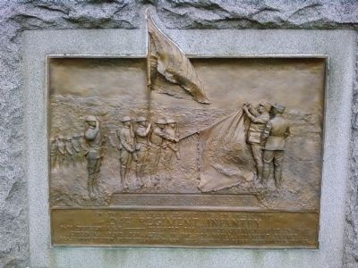
Upper Plaque
"For greatest fighting spirit and self sacrifice during action of April 10, 12, and 13, 1918, suffering from very heavy bombardments and attacked by very strong German forces the 104th Infantry succeeded in preventing their dangerous advance, and with greatest energy reconquered, at the point of the bayonet, the few ruined trenches which had to be abandoned at the first onset, at the same time making prisoners."
On this site August 22, 1917, was organized the 104th Regiment Infantry, 26th Division, A.E.F. --- Departed for service overseas Sept. 26, 1917. Cited as above for action in the Bois Brule, Apremont, France. Exact Reproduction of photograph taken April 28, 1918, at Bouco, Toul Section, France.
Lower Plaque
A Valourous Regiment. Was the decisive element in the attack launched from 8th of November to the 11th of December 1944 in Lorraine. On the 8th December 1944 smashed a system of forts of the Maginot Lien thus liberating the last parcel of French territory then held by the enemy inflicting heavy casualties. 1428 prisoners, 3000 wounded and 700 killed. Paris, 3 November 1945 deGaulle
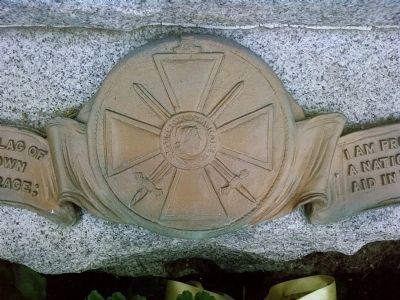
Ribbon on monument base
"I am proud to decorate the flag of a regiment which as shown such fortitude and courage; I am proud to decorate the flag of a nation which has come to our aid in the fight for liberty." Gen Passaga
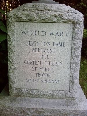
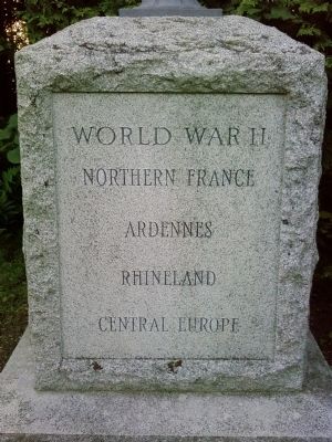
Topics. This memorial is listed in these topic lists: War, World I • War, World II.
Location. 42° 9.821′ N, 72° 43.517′ W. Marker is in Westfield, Massachusetts, in Hampden County. Memorial can be reached from Southampton Road (U.S. 202) 0.8 miles south of Falcon Drive / Summit Lock Road, on the left when traveling south. US202 is co-signed as Massachusetts Route 10. Touch for map. Marker is in this post office area: Westfield MA 01085, United States of America. Touch for directions.
Other nearby markers. At least 8 other markers are within 7 miles of this marker, measured as the crow flies. 104th Infantry Regiment (within shouting distance of this marker); Apremont Park (within shouting distance of this marker); Gen. Henry Knox Trail (approx. 3.2 miles away); IX Miles to Springfield Courthouse (approx. 3.2 miles away); Westfield Civil War Monument (approx. 3.3 miles away); Lieut. Richard Falley (approx. 3.3 miles away); Sheard Playground (approx. 6 miles away); Veterans Memorial (approx. 6.1 miles away). Touch for a list and map of all markers in Westfield.
Related markers. Click here for a list of markers that are related to this marker.
Also see . . . Video series. a series of videos about the 104th Infantry (Submitted on June 6, 2012, by Lee Hattabaugh of Capshaw, Alabama.)
Credits. This page was last revised on October 16, 2020. It was originally submitted on June 6, 2012, by Lee Hattabaugh of Capshaw, Alabama. This page has been viewed 582 times since then and 18 times this year. Photos: 1, 2, 3, 4, 5, 6. submitted on June 6, 2012, by Lee Hattabaugh of Capshaw, Alabama. • Bill Pfingsten was the editor who published this page.
