Marker Logo HMdb.org THE HISTORICAL
MARKER DATABASE
“Bite-Size Bits of Local, National, and Global History”
Hull in Plymouth County, Massachusetts — The American Northeast (New England)
 

Fort Independence


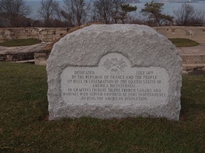
Fort Independence Marker image. Click for full size.
Photographed By Bryan Simmons, December 23, 2011
1. Fort Independence Marker
Inscription. Dedicated July 14th by the Republic of France and the people of Hull in celebration of the United States of America bicentennial. In grateful tribute to the French sailors and marines who served and died at Fort Independence during the American Revolution.
 
Erected 1976.
 
Topics. This historical marker is listed in these topic lists: Forts and CastlesWar, US Revolutionary. A significant historical date for this entry is July 14, 1974.
 
Location. 42° 18.269′ N, 70° 54.205′ W. Marker is in Hull, Massachusetts, in Plymouth County. Marker can be reached from Fort Revere Park. Touch for map. Marker is in this post office area: Hull MA 02045, United States of America. Touch for directions.
 
Other nearby markers. At least 8 other markers are within walking distance of this marker. Bernice James DePasquali (approx. 0.2 miles away); Strangers Corner (approx. 0.2 miles away); Gold Star Mothers Monument (approx. 0.2 miles away); Hull (approx. ¼ mile away); John Boyle O'Reilly (approx. ¼ mile away); British Marine Burial Site (approx. ¼ mile away); Lt. William Haswell House (approx. ¼ mile away); John Boyle O'Reilly House (approx. ¼ mile away). Touch for a list and map of all markers in Hull.
 
Regarding Fort Independence. Fort Revere was formerly Fort Independence until the name went to a new fort on nearby Castle Island.
 
Paid Advertisement
Click on the ad for more information.
Please report objectionable advertising to the Editor.
Click or scan to see
this page online
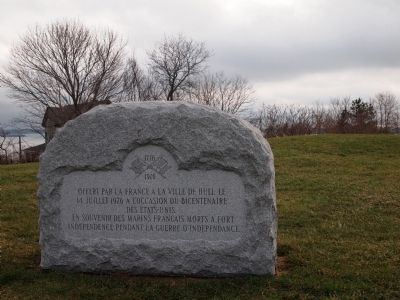
Fort Independence Marker image. Click for full size.
Photographed By Bryan Simmons, December 23, 2011
2. Fort Independence Marker
Backside of the marker in French
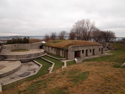
Fort now remodeled around 1900 by the Endicott Taft Coastal Defense Project image. Click for full size.
Photographed By Bryan Simmons, March 22, 2012
3. Fort now remodeled around 1900 by the Endicott Taft Coastal Defense Project
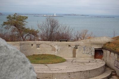
Boston Harbor Lighthouse in the distance image. Click for full size.
Photographed By Bryan Simmons, March 22, 2012
4. Boston Harbor Lighthouse in the distance
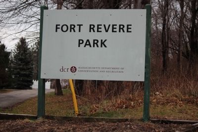
Fort Revere image. Click for full size.
Photographed By Bryan Simmons, December 23, 2011
5. Fort Revere
 
 
Credits. This page was last revised on June 16, 2016. It was originally submitted on June 6, 2012, by Bryan Simmons of Attleboro, Massachusetts. This page has been viewed 659 times since then and 15 times this year. Photos:   1, 2, 3, 4, 5. submitted on June 6, 2012, by Bryan Simmons of Attleboro, Massachusetts. • Bill Pfingsten was the editor who published this page.
Share this page.  
Share on Tumblr
m=56068

CeraNet Cloud Computing sponsors the Historical Marker Database.
This website earns income from purchases you make after using our links to Amazon.com. We appreciate your support.
Paid Advertisement
Apr. 19, 2024