El Dorado in Butler County, Kansas — The American Midwest (Upper Plains)
Oil Field Boom Towns
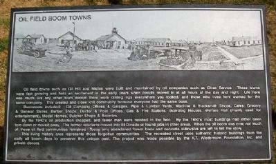
Oil field towns such as Oil Hill and Midian were built and maintained by oil companies such as Cities Service. These towns were fast growing and held an excitment in the early years when people moved in at all hours of the day and night. Life here was much like any other town except there were drilling rigs everywhere you looked, and those who lived here worked for the same company. This created and [sic] close knit community because everyone had the same boss.
Business included: Oil Company Offices & Garages, Pipe & Lumber Yards, Machine & Blacksmith Shops, Cafes, Grocery & General Stores, Barber Shops, Doctor & Post Offices, Gas & Fire Stations, Boarding Houses, Welfare Hall (mainly used for entertainment), Model Homes, Butcher Shops & Bakeries.
By the 1940's oil production dropped, and fewer men were needed in the field. By the 1950's most buildings had either been torn down or moved away. The former residents moved into El Dorado or found jobs in other areas. When the oil boom was over, not much of these oil field communities remained. Today only abandoned flower beds and concrete sidewalks are left to tell the story.
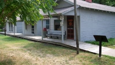
This living history area represents those forgotten communities. The recreated street uses authentic historic buildings from the early oil boom days to preserve this unique past. The project was made possible by the K.T. Wiedermann Foundation, Inc. and private donors.
Erected by Kansas Oil Museum.
Topics. This historical marker is listed in these topic lists: Industry & Commerce • Settlements & Settlers.
Location. 37° 48.971′ N, 96° 50.669′ W. Marker is in El Dorado, Kansas, in Butler County. Marker is in the fenced outdoor Kansas Oil Museum exhibit area of the Butler County History Center. Touch for map. Marker is at or near this postal address: 383 East Central Avenue (US 54), El Dorado KS 67042, United States of America. Touch for directions.
Other nearby markers. At least 8 other markers are within walking distance of this marker. Union Tank Car (a few steps from this marker); Flare (within shouting distance of this marker); Grandma Anderson's House (within shouting distance of this marker); Mrs. Addie Cowley Bradley (within shouting distance of this marker); Kansas Oil Museum (within shouting distance of this marker); Cable Tool Drilling Rig (within shouting distance of this marker); Steel Oil Derrick / 1930's Cable-Tool Drilling Rig (about 300 feet away, measured in a direct line); Alfred Washington Ellet (about 300 feet away). Touch for a list and map of all markers in El Dorado.
Also see . . . Butler County History Center and Kansas Oil Museum. (Submitted on June 8, 2012, by William Fischer, Jr. of Scranton, Pennsylvania.)
Credits. This page was last revised on August 31, 2020. It was originally submitted on June 8, 2012, by William Fischer, Jr. of Scranton, Pennsylvania. This page has been viewed 765 times since then and 19 times this year. Photos: 1, 2. submitted on June 8, 2012, by William Fischer, Jr. of Scranton, Pennsylvania.

