Monteagle in Grundy County, Tennessee — The American South (East South Central)
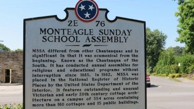
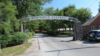
Monteagle Sunday School Assembly
Erected by Tennessee Historical Commission. (Marker Number 2E 76.)
Topics and series. This historical marker is listed in this topic list: Education. In addition, it is included in the Tennessee Historical Commission series list. A significant historical year for this entry is 1883.
Location. 35° 14.432′ N, 85° 50.273′ W. Marker is in Monteagle, Tennessee, in Grundy County. Marker is at the intersection of Assembly Avenue (Tennessee Route 41-a) and College Street, on the right when traveling north on Assembly Avenue. Touch for map. Marker is in this post office area: Monteagle TN 37356, United States of America. Touch for directions.
Other nearby markers. At least 8 other markers are within 2 miles of this marker, measured as the crow flies. Grundy County / Marion County (approx. ¼ mile away); The Amphitheater (approx. ¼ mile away); The Dawn Redwood of Monteagle (approx. 0.4 miles away); Trail of Tears (approx. half a mile away); RyeMabee 1930 (approx. half a mile away); Crossroads of War (approx. 0.6 miles away); Tullahoma Campaign (approx. 0.9 miles away); Struggling Through the Mountains (approx. 1.3 miles away). Touch for a list and map of all markers in Monteagle.
Also see . . .
1. Chautauqua. Wikipedia (Submitted on June 9, 2012, by Tom Gillard of Tullahoma, Tennessee.)
2. Monteagle Sunday School Assembly. (Submitted on June 11, 2012, by Bernard Fisher of Richmond, Virginia.)
Credits. This page was last revised on June 16, 2016. It was originally submitted on June 9, 2012, by Tom Gillard of Tullahoma, Tennessee. This page has been viewed 1,254 times since then and 18 times this year. Photos: 1, 2, 3, 4, 5. submitted on June 9, 2012, by Tom Gillard of Tullahoma, Tennessee. • Bernard Fisher was the editor who published this page.
