Near Sharpsburg in Washington County, Maryland — The American Northeast (Mid-Atlantic)
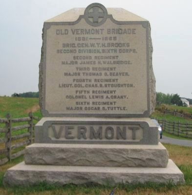
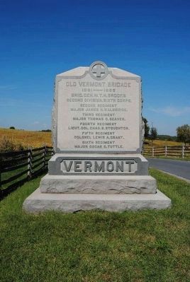
Old Vermont Brigade
Brig. Gen. W. T. H. Brooks
Second Division, Sixth Corps
Second Regiment
Major James H. Walbridge.
Third Regiment
Major Thomas O. Seaver.
Fourth Regiment
Lieut. Col. Chas. B. Stroughton.
Fifth Regiment
Colonel Lewis A. Grant
Sixth Regiment
Major Oscar S. Tuttle.
Vermont
Topics. This historical marker is listed in this topic list: War, US Civil. A significant historical date for this entry is September 17, 1866.
Location. 39° 28.362′ N, 77° 44.587′ W. Marker is near Sharpsburg, Maryland, in Washington County. Marker is on Mummas Lane, on the right when traveling south. Touch for map. Marker is in this post office area: Sharpsburg MD 21782, United States of America. Touch for directions.
Other nearby markers. At least 10 other markers are within walking distance of this marker. “A Thrilling Spectacle” (about 400 feet away, measured in a direct line); I Found the Enemy in Great Force (about 400 feet away); Battery A, 1st Rhode Island Light Artillery (about 500 feet away); 1st Delaware Volunteers (about 700 feet away); Colquitt's and Garland's Brigades (about 700 feet away); Sixth Army Corps (about 700 feet away); Couch's Division, Fourth Army Corps (about 700 feet away); A Deadly Struggle (about 700 feet away); Fourteenth Connecticut Volunteer Infantry (about 700 feet away); 5th Maryland Infantry (about 800 feet away). Touch for a list and map of all markers in Sharpsburg.
Regarding Old Vermont Brigade. This marker is included on the Sunken Road or Bloody Lane Virtual Tour by Markers see the Virtual tour link below to see the markers in sequence.
Related markers. Click here for a list of markers that are related to this marker. Vermont Units at Antietam
Also see . . .
1. Old Vermont Brigade Monument. National Park Service page detailing the monument. (Submitted on February 22, 2008, by Craig Swain of Leesburg, Virginia.)
2. 2nd Brigade, 2nd Division, VI Corps. The Vermont Brigade is one of the Army of the Potomac's most storied units. (Submitted on February 22, 2008, by Craig Swain of Leesburg, Virginia.)
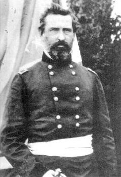
3. William T.H. Brooks. William Thomas Harbaugh Brooks (January 28, 1821 – July 19, 1870) was a career military officer in the United States Army, serving as a major general during the American Civil War. (Submitted on October 25, 2015, by Brian Scott of Anderson, South Carolina.)
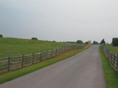
Photographed By Craig Swain, August 5, 2007
3. Looking North on Mummas Lane
The Brooks', otherwise known as the Vermont, Brigade defended this section north of the Sunken Road in the afternoon of the battle, with their right flank anchored about where the monument is located today. This view is looking at the monument from the intersection of Mumma's Lane and Richardson Avenue.
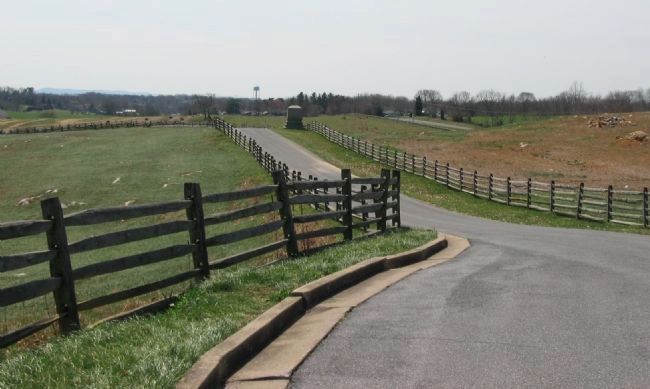
Photographed By Craig Swain, March 29, 2008
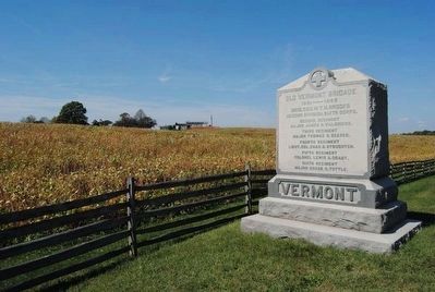
6. Looking South down Mumma's Lane at the Monument
The monument stands near the seam between the Vermont Brigade and Irwin's Brigade as both defended this sector during the afternoon. The Vermont Brigade extended their line from the road here off to the left, covering the ground in front of the Sunken Road.
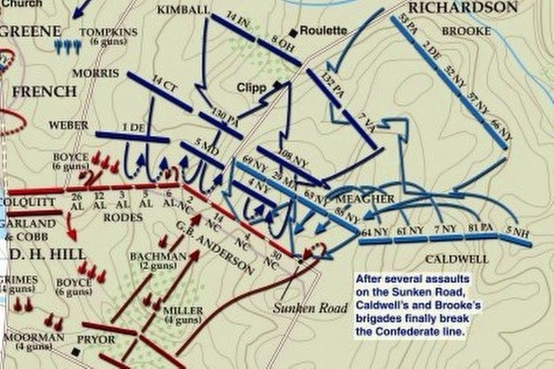
via American Battlefield Trust, unknown
7. Sunken Road or Bloody Lane Virtual Tour by Markers.
A collection of markers interpreting the action of during the Battle of Antietam around the Sunken Road.
(Submitted on February 23, 2008, by Craig Swain of Leesburg, Virginia.)
Click for more information.
(Submitted on February 23, 2008, by Craig Swain of Leesburg, Virginia.)
Click for more information.
Credits. This page was last revised on April 3, 2022. It was originally submitted on February 22, 2008, by Craig Swain of Leesburg, Virginia. This page has been viewed 923 times since then and 17 times this year. Photos: 1. submitted on February 22, 2008, by Craig Swain of Leesburg, Virginia. 2. submitted on October 25, 2015, by Brian Scott of Anderson, South Carolina. 3. submitted on February 22, 2008, by Craig Swain of Leesburg, Virginia. 4, 5. submitted on October 25, 2015, by Brian Scott of Anderson, South Carolina. 6. submitted on April 8, 2008, by Craig Swain of Leesburg, Virginia. 7. submitted on April 3, 2022, by Larry Gertner of New York, New York.
