Near Poteet in Atascosa County, Texas — The American South (West South Central)
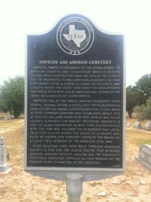
Amphion and Amphion Cemetery
Amphion was at one time a thriving community with several general stores, a hotel, post office, blacksmith shop, cotton gin, tannery, churches, fraternal lodges and a school. Amphion Cemetery was established about 1870 at this site on land donated by Roy Jenkins and Frank Lozano. Although the earliest recorded gravesite is that of Laura Underwood (d.1891) there is a gravestone with the year 1800 inscribed on its surface that local tradition claims marks the grave of a young boy killed by Indians. This cemetery contains the graves of at least two veterans of the American Civil War.
When railroad lines were built through Atascosa County in 1907 and 1927 along routes that bypassed Amphion, business activity declined and the community eventually dissolved. Virtually all that remains of the former town of Amphion is this cemetery. (1992)
Erected 1992 by Texas Historical Commission. (Marker Number 155.)
Topics. This historical marker is listed in these topic lists: Cemeteries & Burial Sites • Settlements & Settlers. A significant historical year for this entry is 1857.
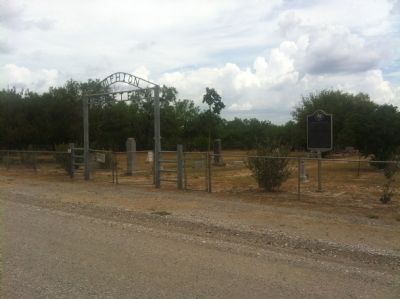
Location. 28° 59.98′ N, 98° 37.91′ W. Marker is near Poteet, Texas, in Atascosa County. Marker is on County Road 304, half a mile east of Farm to Market Road 2146. From Poteet, take FM 476 West about .5 miles, then go South as FM 2146 about 4 miles, make a left onto County Road at Amphion Community. Cemetery will be on left. Touch for map. Marker is in this post office area: Poteet TX 78065, United States of America. Touch for directions.
Other nearby markers. At least 8 other markers are within 8 miles of this marker, measured as the crow flies. Site of Jose Antonio Navarro Ranch Headquarters (approx. 3.3 miles away); Kings Highway Camino Real — Old San Antonio Road (approx. 3˝ miles away); Poteet (approx. 4.2 miles away); a different marker also named Kings Highway Camino Real — Old San Antonio Road (approx. 6.2 miles away); Anchorage Cemetery (approx. 6.6 miles away); Rossville (approx. 6.7 miles away); St. Matthew Catholic Parish (approx. 7.4 miles away); Rossville Cemetery (approx. 7˝ miles away). Touch for a list and map of all markers in Poteet.
Credits. This page was last revised on June 16, 2016. It was originally submitted on June 20, 2012, by John A Hensarling of Campbellton, Texas. This page has been viewed 805 times since then and 54 times this year. Photos: 1, 2. submitted on June 21, 2012, by John A Hensarling of Campbellton, Texas. • Craig Swain was the editor who published this page.

