Near Sharpsburg in Washington County, Maryland — The American Northeast (Mid-Atlantic)
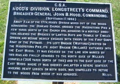
Hood's Division, Longstreet's Command
Hood's Division, Longstreet's Command,
Brigadier General John B. Hood, Commanding.
(September 17, 1862.)
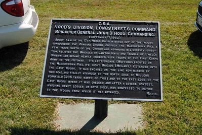
About 7 a.m. of the 17th, Hood's Division moved out of the woods surrounding the Dunkard Church, crossed the Hagerstown Pike a few yards north of the church and, advancing in a northly direction, relieved the Brigades of Lawton, Hays and Trimble of Ewell's Division, and became heavily engaged with troops of the First Corps Army of the Potomac. Its left Brigade (Wofford's) rested on the Hagerstown Pike, its right Brigade (McLaw's) extended into the East Woods. It was engaged on the line now marked by this road, and finally advanced to the north edge of Miller's cornfield (305 yards north of this) and to the east edge of the East Woods where it was checked and, after a severe contest, involving heavy losses on both sides, was compelled to retire to the woods from which it had advanced.
Erected by Antietam Battlefield Board. (Marker Number 310.)
Topics and series. This historical marker is listed in this topic list: War, US Civil. In addition, it is included in the Antietam Campaign War Department Markers series list. A significant historical year for this entry is 1862.
Location. 39° 28.849′ N, 77° 44.829′ W. Marker is near Sharpsburg, Maryland, in Washington County. Marker is on Cornfield Avenue, on the right when traveling east. Located near stop four of the driving tour of Antietam Battlefield and stop six of the Cornfield walking trail. Touch for map. Marker is in this post office area: Sharpsburg MD 21782, United States of America. Touch for directions.
Other nearby markers. At least 8 other markers are within walking distance of this marker. A different marker also named Hood's Division, Longstreet's Command (here, next to this marker); First Army Corps (a few steps from this marker); Texas (a few steps from this marker); 84th New York (14th Brooklyn) Volunteer Infantry (within shouting distance of this marker); "Every Stalk of Corn" (within shouting distance of this marker); A Cornfield Unlike Any Other (within shouting distance of this marker); The Most Terrible Clash of Arms (within shouting distance of this marker); Longstreet's Command (within shouting distance of this marker). Touch for a list and map of all markers in Sharpsburg.
More about this marker. The marker identifies the brigade on the left as McLaw's. This should read Law's Brigade. As with several other in the series, there are some misspellings, such as that of the Dunker Church.
Related markers. Click here for a list of markers that are related to this marker. Hood's Division Markers
Also see . . .
1. Antietam Batlefield. National Park Service site. (Submitted on February 23, 2008, by Craig Swain of Leesburg, Virginia.)
2. Hood's Division. In his official report, Hood would write, "It was here that I witnessed the most terrible clash of arms, by far, that has occurred during the war." (Submitted on February 23, 2008, by Craig Swain of Leesburg, Virginia.)
Photographed By Brian Scott
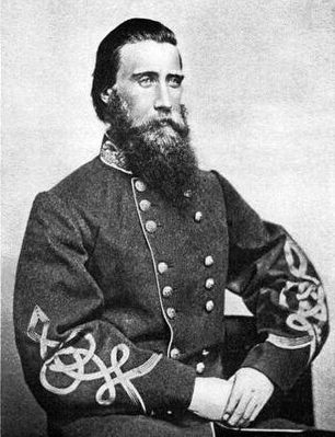
5. Lieut. General John B. Hood (1831-1879)
During the Battle of Antietam, Hood's division came to the relief of Stonewall Jackson's corps on the Confederate left flank, turning back an assault by the Union I Corps in the West Woods. Afterward, they became engaged with the Union XII Corps. In the evening after the battle, Gen. Lee asked Hood where his division was. He responded, "They are lying on the field where you sent them. My division has been almost wiped out." Of his 2,000 men, almost 1,000 were casualties
Photographed By Craig Swain, February 9, 2008
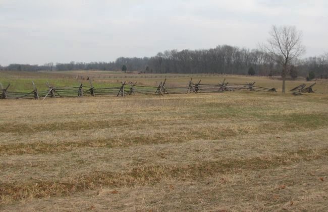
6. The Cornfield
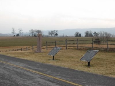
Looking north from the marker's location, the Cornfield was the main objective of Hood's division. The tree line in the upper right distance is part of the East Woods. Notice how the wooden fence drops off in the right center. At that point a ledge runs generally north to south through the cornfield, somewhat dividing the field. This same ledge is seen in Photo 3 above running behind the Texas Monument. Because of this terrain feature, the fighting here in the cornfield actually evolved into two distinct actions - the left side where Wofford's Texas Brigade fought along the Hagerstown Pike and the right side where Law's Brigade fought near the East Woods.
Credits. This page was last revised on September 29, 2017. It was originally submitted on February 23, 2008, by Craig Swain of Leesburg, Virginia. This page has been viewed 1,037 times since then and 24 times this year. Photos: 1. submitted on February 23, 2008, by Craig Swain of Leesburg, Virginia. 2. submitted on October 20, 2015, by Brian Scott of Anderson, South Carolina. 3. submitted on February 23, 2008, by Craig Swain of Leesburg, Virginia. 4, 5. submitted on October 20, 2015, by Brian Scott of Anderson, South Carolina. 6. submitted on February 23, 2008, by Craig Swain of Leesburg, Virginia.
