Near Chester in Plumas County, California — The American West (Pacific Coastal)
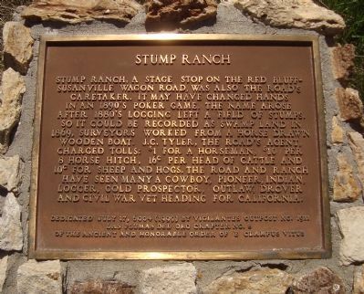
Stump Ranch
Erected 1999 by E Clampus Vitus, Las Plumas del Oro Chapter No. 8, Vigilante Outpost No. 1911.
Topics and series. This historical marker is listed in these topic lists: Agriculture • Notable Places • Roads & Vehicles. In addition, it is included in the E Clampus Vitus series list. A significant historical year for this entry is 1869.
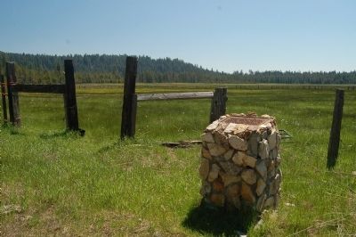
Location. 40° 21.837′ N, 121° 22.62′ W. Marker is near Chester, California, in Plumas County. Marker is on Section Old Red Bluff Road (County Route 311). This markers is 4 miles up Section Old Red Bluff Road (Plumas County Road 311), and 2 miles beyond the end of the paved road at Domingo Springs, from the intersection with Warner Valley Road. Touch for map. Marker is in this post office area: Chester CA 96020, United States of America. Touch for directions.
Other nearby markers. At least 8 other markers are within 9 miles of this marker, measured as the crow flies. 1848 – Lassen Trail – 1849 (approx. 7.3 miles away); Dave Stratford 1945 – 2001 (approx. 8½ miles away); Chester Veterans Memorial Plaza (approx. 8½ miles away); "Dinky" (approx. 8.6 miles away); Olde Towne Corner Store (approx. 8.7 miles away); Char's Beauty Salon (approx. 8.7 miles away); Chester Library (approx. 8.7 miles away); Mt. Lassen Club (approx. 8.7 miles away). Touch for a list and map of all markers in Chester.
Credits. This page was last revised on June 16, 2016. It was originally submitted on June 24, 2012, by Barry Swackhamer of Brentwood, California. This page has been viewed 979 times since then and 17 times this year. Photos: 1, 2, 3, 4, 5. submitted on June 24, 2012, by Barry Swackhamer of Brentwood, California. • Syd Whittle was the editor who published this page.


