Wichita in Sedgwick County, Kansas — The American Midwest (Upper Plains)
1854 Treaty Oration Excerpt
Chief Seattle of the Suquamish
— American Indian Trail Walk Path —
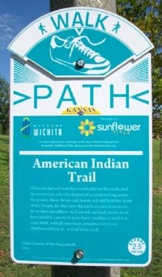
When the last red man has vanished from the earth, and his memory is only the shadow of a cloud moving across the prairie, these shores and forests will still hold the spirit of my People, for they love the earth as a newborn loves its mother's heartbeat. So if we sell our land, love it as we have loved it, care for it as we have cared for it, hold it in your mind, with all your heart, preserve it for your children and love it - as God loves us all.
Chief Seattle of the Suquamish
1854
For more information on other great American Indians visit www.theindiancenter.org
Erected by City of Wichita and Sunflower Title.
Topics. This historical marker is listed in these topic lists: Environment • Native Americans. A significant historical year for this entry is 1854.
Location. 37° 41.549′ N, 97° 21.002′ W. Marker is in Wichita, Kansas, in Sedgwick County. Marker is along the Arkansas River Path, halfway between the Central Avenue Bridge and the pedestrian bridge leading to Keeper of the Plains, and about 400 feet ENE of the Mid-America All-Indian Center. Touch for map. Marker is in this post office area: Wichita KS 67202, United States of America. Touch for directions.
Other nearby markers. At least 8 other markers are within walking distance of this marker. Chiefs (about 300 feet away, measured in a direct line); Ceremonial Pipes (about 300 feet away); Eagles (about 300 feet away); Way of the Horse (about 300 feet away); Tipis (about 300 feet away); Dream Animals (about 300 feet away); Ceremony (about 400 feet away); Warriors (about 400 feet away). Touch for a list and map of all markers in Wichita.
Also see . . . Chief Seattle's Treaty Oration of 1854. Solar Haven website entry (Submitted on July 26, 2022, by Larry Gertner of New York, New York.)
Credits. This page was last revised on December 2, 2023. It was originally submitted on June 24, 2012, by William Fischer, Jr. of Scranton, Pennsylvania. This page has been viewed 689 times since then and 36 times this year. Photos: 1, 2. submitted on June 24, 2012, by William Fischer, Jr. of Scranton, Pennsylvania.

