East Town in Milwaukee in Milwaukee County, Wisconsin — The American Midwest (Great Lakes)
Historic Milwaukee
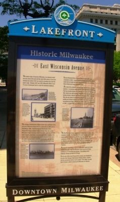
East Wisconsin Avenue
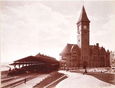
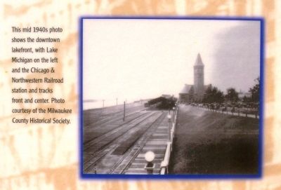
The Chicago & Northwestern Railway Station was a landmark at the east end of Wisconsin Avenue from its construction in 1889 until its demolition in 1968. The Richardsonian Romanesque station, designed by Chicago architect Charles Sumner Frost, was among Milwaukee’s largest structures when it was built, supported by heavy walls of granite, brownstone, and red pressed brick. It replaced the original depot, an unprepossessing wooden structure at the same site, which had been built in 1872-73. For decades, until the land was filled in, the railroad tracks were not far from the water’s edge.
Lincoln Memorial drive, made possible by the landfill, was completed in 1929. Lincoln Memorial Bridge spanned the railroad tracks that ran below the bluff along the lakefront and connected Mason Street and Lincoln Memorial Drive.
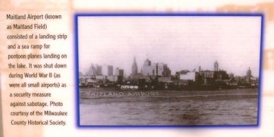
For most of its existence, the downtown lakefront was a working lakefront. A municipal airport built in 1927 and known as Maitland Field was located between the railroad tracks and Lake Michigan. A Nike missile site, built to protect Milwaukee from potential Russian bomber attacks, replaced the airport in the early 1950s. After the Nike site closed, the downtown lakefront was used for auto parking and storage until the early 1980s when redevelopment for recreational use began. Between the 1960s until it was demapped in 1981, a corridor along the lakefront was set aside for a freeway.
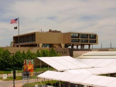
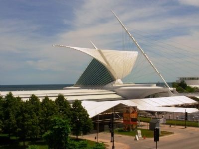
The War Memorial Center, designed by architect Eero Saarinen, was completed in 1957. The Milwaukee Art Center occupied space in the upper portion of the building until the lower level galleries were completed in 1963. These were enlarged between 1970 and 1975. In 1980 the name was changed to the Milwaukee Art Museum. The newest addition opened in 2001 and was designed by Santiago Calatrava.
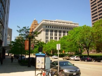
At about the same time, in 1971-73, Wisconsin’s largest and tallest building was built—the First Wisconsin Center (now the US Bank building) at 777 East Wisconsin Avenue. The architects were Skidmore, Owings and Merrill of Chicago.
In the early 1990s, the O’Donnell Park complex was developed on the site of the Chicago & Northwestern Railway Station, complete with the abstract steel sculpture “The Calling” by artist Mark di Suvero, which is owned by the Milwaukee Art Museum.
Topics. This historical marker is listed in these topic lists: Railroads & Streetcars
• Roads & Vehicles • Settlements & Settlers. A significant historical year for this entry is 1917.
Location. 43° 2.34′ N, 87° 54.011′ W. Marker is in Milwaukee, Wisconsin, in Milwaukee County. It is in East Town. Marker is at the intersection of East Wisconsin Avenue and North Prospect Avenue, on the right when traveling east on East Wisconsin Avenue. Touch for map. Marker is at or near this postal address: 875 E Wisconsin Ave, Milwaukee WI 53202, United States of America. Touch for directions.
Other nearby markers. At least 8 other markers are within walking distance of this marker. A different marker also named Historic Milwaukee (about 500 feet away, measured in a direct line); Service Star Legion World War I Memorial (about 700 feet away); Abraham Lincoln (about 800 feet away); Brig. Gen. Rufus King’s Home (approx. 0.2 miles away); Milwaukee County War Memorial (approx. 0.2 miles away); First Milwaukee Cargo Pier (approx. 0.2 miles away); Northwestern National Insurance Company (approx. 0.2 miles away); a different marker also named Historic Milwaukee (approx. 0.2 miles away). Touch for a list and map of all markers in Milwaukee.
Photographed By Paul Fehrenbach, June 7, 2012
3. Historic Milwaukee Marker
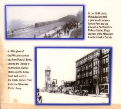
Upper Left Photos: Top – In this 1889 photo, Milwaukeeans stroll a promenade between Juneau Park and the Chicago & Northwestern Railway Station. Photo courtesy Milwaukee County Historical Society
Bottom – A 1920s photo of East Wisconsin Avenue east from Marshall Street, showing the Chicago & Northwestern Railway Station and the Juneau Hotel, both razed in the 1960s. Historic Photo Collection / Milwaukee Public Library
Photographed By Paul Fehrenbach, June 7, 2012
4. Historic Milwaukee Marker
Lower Left Photo: Maitland Airport (known as Maitland Field) consisted of a landing strip and a sea-ramp for pontoon planes landing on the lake. It was shut down during World War II (as were all small airports) as a security measure against sabotage. Photo courtesy of the Milwaukee County Historical Society.
Photographed By Paul Fehrenbach, June 7, 2012
5. Historic Milwaukee Marker
Photo Middle Right: This mid 1940s photo shows the downtown lakefront, with Lake Michigan on the left and the Chicago & Northwestern Railroad station and tracks front and center. Photo courtesy of the Milwaukee County Historical Society.
Credits. This page was last revised on February 16, 2023. It was originally submitted on June 27, 2012, by Paul Fehrenbach of Germantown, Wisconsin. This page has been viewed 1,287 times since then and 45 times this year. Photos: 1, 2, 3, 4, 5, 6, 7, 8, 9, 10. submitted on June 27, 2012, by Paul Fehrenbach of Germantown, Wisconsin. 11. submitted on November 16, 2014. • Bernard Fisher was the editor who published this page.
