Near Rainbow Wells in San Bernardino County, California — The American West (Pacific Coastal)
Pozos de San Juan de Dios
Erected 1972 by Hospitaller Brothers of St. John of God, St. Mary Desert Valley Hospital Apple Valley, California in cooperation with the San Bernardino County Museum.
Topics and series. This historical marker is listed in these topic lists: Churches & Religion • Exploration. In addition, it is included in the Mojave Road (Old Government Road) series list. A significant historical month for this entry is March 1923.
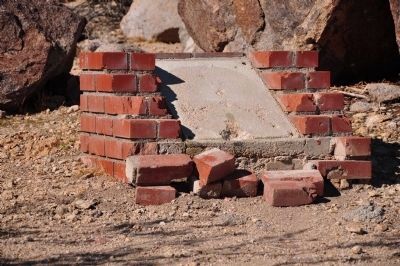
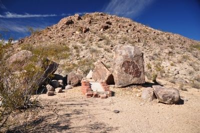
Location. Marker has been reported missing. It was located near 35° 10.147′ N, 115° 38.891′ W. Marker was near Rainbow Wells, California, in San Bernardino County. Marker could be reached from Old Government Road. Marker is located on the Mojave National Preserve and is on what became the Mojave Trail (Old Government Road.). Touch for map. Marker was in this post office area: Boron CA 93516, United States of America. Touch for directions.
Other nearby markers. At least 3 other markers are within 11 miles of this location, measured as the crow flies. The Mojave Road (approx. 7.9 miles away); Kelso Jail (approx. 10.8 miles away); Kelso Depot (approx. 10.9 miles away).
Regarding Pozos de San Juan de Dios. The plaque was placed many years ago by a Catholic organization that thought this site was Pozos de San Juan de Dios. Since then most historians who have studied Garcés’ route have determined that this information is incorrect. It has been decided that the marker will not be replaced.
Credits. This page was last revised on November 17, 2020. It was originally submitted on January 2, 2012, by Michael Kindig of Elk Grove, California. This page has been viewed 685 times since then and 15 times this year. Last updated on June 29, 2012, by Michael Kindig of Elk Grove, California. Photos: 1. submitted on January 3, 2012, by Michael Kindig of Elk Grove, California. 2, 3. submitted on January 2, 2012, by Michael Kindig of Elk Grove, California. • Syd Whittle was the editor who published this page.
![Pozos de San Juan de Dios<br>[Marker Missing]. Click for full size. Pozos de San Juan de Dios<br>[Marker Missing] image. Click for full size.](Photos1/187/Photo187832.jpg?13201265500PM)

