Merry Hill in Bertie County, North Carolina — The American South (South Atlantic)
Salmon Creek and Eden House: Seedbed of the Colony
Inscription.
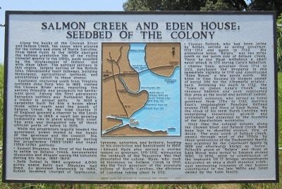
Along the banks of the Chowan River and Salmon Creek, the seeds were planted for the colony and state of North Carolina. From these roots in the 1600s emerged the refined plantation life of the ruling colonial gentry in the 1700s, made possible by the displacement of Indians and with slave labor. The earliest settlers in this region, largely natives of the British Isles, transplanted their folkways, building techniques, agricultural methods, and adventurous spirit to these shores.
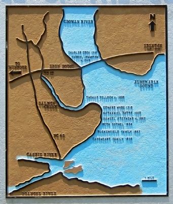
Explorers venturing south from Virginia included John Pory who in 1622 visited the Chowan River area, reporting the natives friendly and prospects for settlement good. Among the first permanent European settlers was Nathaniel Batts, a trader in animal pelts. In 1655 a carpenter built for him a house about three miles south near the mouth of Salmon Creek. By the time Charles II of England granted a charter to the Lords Proprietors in 1663, a small but growing community was in place along this river. The area was designated one of three official ports of entry in 1676.
While the proprietors legally headed the government, power rested in the hands of the governor and the council. Six colonial governors lived nearby during the proprietary (1663-1729) and royal (1729-1776) periods:
* Samuel Stephens, the first of the leaders to settle on Salmon Creek, encountered dissension and despair among the colonists during his term, 1667-1670.
* Seth Sothel in 1684 acquired 4,000 acres where Batts and Stephens had lived. As governor beginning in 1682, Sothel incurred charges of oppression, tyranny, extortion, and bribery, leading to his conviction and banishment in 1689.
* Edward Hyde also served a stormy tenure as governor, 1711-1712, witnessing the outbreak of the Tuscarora War that devastated the colony. Hyde, who took up residence on Salmon Creek in 1710, was the first governor of the separate colony of North Carolina, the division of Carolina taking place in 1712.
* Thomas Pollock, who had been jailed by Sothel, served as acting governor, 1712-1714 and again in 1722. His plantation house, “Balgra,” was two miles south on the north side of Salmon Creek. There he and Hyde withstood a small naval attack in 1711 during Cary’s Rebellion.
* Charles Eden, governor from 1714 to 1722, purchased the property in this immediate vicinity in 1719 and constructed “Eden House” a few yards north. His home in time became an elegant center of social life for the Albemarle aristocracy. Following his death in 1722, the “Town on Queen Anne’s Creek” was renamed Edenton and soon supplanted this area as the social and political center.
* Gabriel Johnston,
who served as royal governor from 1734 to 1752, married Eden’s stepdaughter Penelope Golland around 1740 and lived at Eden House. By the close of his term North Carolina was undergoing tremendous growth and settlement had extended to the foothills of the Appalachian mountains.
Over time the colonial estates along the Chowan River and Salmon Creek have been lost to shoreline erosion, fire, or decay. The area south of Salmon Creek, owned through most of the 1700s by three generations of the Duckenfield family, was acquired by the Capeheart family in 1829 and afterwards known as “Avoca.” Pollock’s grave at “Balgra” and those at Eden House were moved to Edenton around 1890. In 1996, prior to construction of the improved US 17 bridge, archaeologists excavated an area a short distance southeast uncovering remnants of two houses constructed in the late 1600s and later owned by the Eden family.
Erected 2000 by North Carolina Division of Archives and History. (Marker Number A-10.)
Topics and series. This historical marker is listed in these topic lists: Colonial Era • Government & Politics • Settlements & Settlers. In addition, it is included in the North Carolina Division of Archives and History series list. A significant historical year for this entry is 1622.
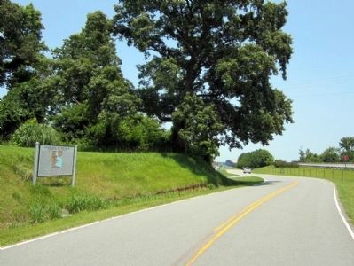
Location. 36° 2.487′ N, 76° 42.565′ W. Marker is in Merry Hill, North Carolina, in Bertie County. Marker is at the intersection of Cypress Road and Governor Eden House Road, on the left when traveling east on Cypress Road. Touch for map. Marker is in this post office area: Merry Hill NC 27957, United States of America. Touch for directions.
Other nearby markers. At least 8 other markers are within 6 miles of this marker, measured as the crow flies. A look back at our history (approx. 4.1 miles away); "Scotch Hall" (approx. 4.2 miles away); Weapemeoc (approx. 5.3 miles away); Roanoke River Lighthouse (approx. 5.6 miles away); 1886 Roanoke River Lighthouse (approx. 5.6 miles away); Thomas Child (approx. 5.6 miles away); Escape Via Maritime Underground Railroad (approx. 5.7 miles away); Edenton (approx. 5.7 miles away).
More about this marker. Erected in June 2001, the large marker replaced four older markers, all of which were scrapped when construction commenced on the new US 17 bridge across the Chowan River. The older markers were dedicated to Eden House, home of Governor Charles Eden; Edward Hyde, colonial governor; Batts House, the first known home of a permanent settler of European descent; and Thomas Pollock, another colonial governor.
Credits. This page was last revised on June 16, 2016. It was originally submitted on June 30, 2012, by Bernard Fisher of Richmond, Virginia. This page has been viewed 1,378 times since then and 115 times this year. Photos: 1, 2, 3. submitted on June 30, 2012, by Bernard Fisher of Richmond, Virginia.


