Niagara Falls in Niagara Region, Ontario — Central Canada (North America)
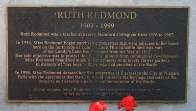
Ruth Redmond
1903 - 1999
In 1954, Miss Redmond began purchasing properties that were adjacent to her home here on the north side of Lundy's Lane. This valuable land was part of the Lundy's Lane Battleground from the War of 1812. Her sole objective was to protect this historic ground from commercial development. Miss Redmond beautified much of her property with lovely flower gardens in memory of "her boys" - those who had perished in the Battle.
In 1996, Miss Redmond donated her five properties (1.5 acres) to the City of Niagara Falls with the agreement that the City would conserve the heritage character of the property and develop a park in commemoration of the Battle.
At her request, Miss Redmond's cremated remains are resting here in her beloved Shangri-La Gardens.
Topics. This historical marker is listed in these topic lists: Cemeteries & Burial Sites • War of 1812 • Women. A significant historical year for this entry is 1926.
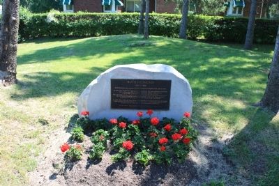
Location. 43° 5.418′ N, 79° 5.773′ W. Marker is in Niagara Falls, Ontario, in Niagara Region. Marker can be reached from the intersection of Hanan Avenue and Latshaw Street. This historic marker is north of the Drummond Hill Cemetery, a short distance north of the street, Lundy's Lane, and is located along a footpath in Battlefield Park, in the middle of a small grove of trees that is just south of the park's playground area (and a short distance behind the residence at 5797 Hanan Avenue). Touch for map. Marker is at or near this postal address: 5797 Hanan Avenue, Niagara Falls ON L2G 4E8, Canada. Touch for directions.
Other nearby markers. At least 8 other markers are within walking distance of this marker. British Retreat (within shouting distance of this marker); Bicentennial of the Battle of Lundy’s Lane (within shouting distance of this marker); Americans Withdraw (within shouting distance of this marker); Battle Ground Hotel (within shouting distance of this marker); The British Defense (within shouting distance of this marker); Battlefield Tourism (within shouting distance of this marker); War of 1812 (within shouting distance of this marker); Lundy’s Lane Battlefield Gateway (within shouting distance of this marker). Touch for a list and map of all markers in Niagara Falls.
More about this marker. With regards to the location of this historic marker in relation to the other historic markers for the Battle of Lundy's Lane that are all located either in, or on the northern boundary of, the Drummond Hill Cemetery, which is just south of this marker (and on the other side of the street called Lundy's Lane). When I visited this battle site last summer, and only saw the historic markers in the immediate area of the cemetery, I was not overly impressed with the size or height of Drummond Hill and could not visualize the topography of the area playing any particularly significant role in the course of the battle. Even with the historic marker entitled "Holding the High Ground" that was dedicated to General Drummond, I still was not overly impressed with the role that Drummond Hill played in the battle.
However, after I got home and published all of the Battle of Lundy's Lane historic markers that I had harvested during my July 2011 visit to the battlefield, I noticed on the Google Map that there was a park across the street, to the north of the cemetery that was entitled Battlefield Park, that I had neglected to visit and since I was disappointed in the number of battlefield related markers that I had found, I decided that I needed to revisit the area during my next summer visit to see if I could locate any additional markers in the area north of the cemetery.
Although I was disappointed that there weren't more markers in Battlefield Park, and that that the one marker that I found was only indirectly related to the actual events of the battle, I was most appreciative of what the location of the marker revealed to me visually.
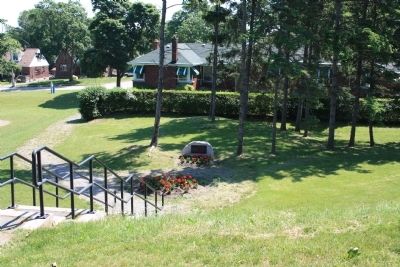
Part of the property that is Battlefield Park is located at what appears to be the northern base of Drummond Hill. When I stand at the base
of the hill and begin to walk southward towards this historic marker I begin to walk up a fairly difficult slope (at least it is difficult for a guy in his 60s who ruined both of his knees playing college football in the early 70s). The marker is located on a small level terrace, on slope of the hill, and if one keeps walking south, beyond the marker, towards the Drummond Hill Cemetery, the angle of the slope becomes even more severe.
It was as a result of visiting the location this historic marker that I could truly begin to appreciate the role that Drummond Hill played in the Battle of Lundy's Lane, and it enabled me to visualize the importance of "Holding the High Ground" during the course of the battle.
For an even better visual of the significance of "Holding the High Ground" during the Battle of Lundy's Lane, go to the "Also see..." site and view the colored print of the battle provided by Canadian Art Cards.

Photographed By Dale K. Benington, June 10, 2012
4. Ruth Redmond Marker
View looking south from near the center of Battlefield Park. The historic marker cannot be seen, but it is located in the grove of pine trees in the center/left of the picture. In the distant background is the church tower of Battleground Church, with the Drummond Hill Cemetery being located to the left of the tower.
Credits. This page was last revised on September 27, 2019. It was originally submitted on July 2, 2012, by Dale K. Benington of Toledo, Ohio. This page has been viewed 737 times since then and 19 times this year. Photos: 1, 2, 3, 4. submitted on July 2, 2012, by Dale K. Benington of Toledo, Ohio.


