Near Sharpsburg in Washington County, Maryland — The American Northeast (Mid-Atlantic)
Jackson's Command
Ripley's Brigade, D.H. Hill's Division
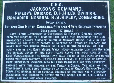
Jackson's Command,
Ripley's Brigade, D.H. Hill's Division,
Brigadier General R.S. Ripley, Commanding.
Organization.
1st and 3rd North Carolina, 4th and 44th Georgia Infantry.
(Septemer 17, 1862.)
Late in the afternoon of September 16, Ripley's Brigade moved from the right of the division line near the Boonsboro Pike and bivouacked a short distance south of Mumma's House. Early in the morning of the 17th it formed in support of Trimble's Brigade and moved past the burning Mumma buildings in the direction of the south end of the East Woods. When Hood relieved Lawton's Division the brigade moved by the left flank along the west edge of the East Woods, crossed the Smoketown Road south of this point and moved north to Hood's support. It filled an interval in the line of battle, made successive charges into Miller's Cornfield and was severely engaged with the advance of the Twelfth Corps. The right of the Confederate line being turned by an attack of Green's Division, Twelfth Corps, the Brigade after several changes of position and a stubborn resistance was obliged to retire to the woods around the Dunkard Church and was not again engaged.
Erected by Antietam Battlefield Board. (Marker Number 337.)
Topics and series. This historical marker is listed in this topic list: War, US Civil. In addition, it is included in the Antietam Campaign War Department Markers series list. A significant historical date for this entry is September 17, 1862.
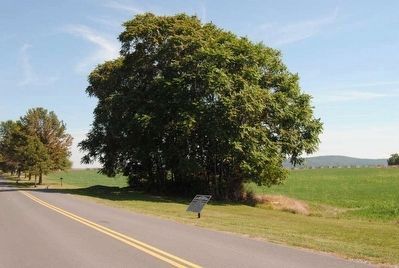
Location. 39° 28.864′ N, 77° 44.65′ W. Marker is near Sharpsburg, Maryland, in Washington County. Marker is on Cornfield Avenue, on the right when traveling west. Located between stops three and four of the driving tour of Antietam Battlefield. Touch for map. Marker is in this post office area: Sharpsburg MD 21782, United States of America. Touch for directions.
Other nearby markers. At least 10 other markers are within walking distance of this marker. First Army Corps (a few steps from this marker); a different marker also named First Army Corps (a few steps from this marker); Battery B (a few steps from this marker); Ricketts' Division, First Army Corps (a few steps from this marker); U.S. Artillery (a few steps from this marker); a different marker also named Jackson's Command (within shouting distance of this marker); 90th Pennsylvania (within shouting distance of this marker); First New Jersey Brigade (within shouting distance of this marker); 27th Indiana Infantry (within shouting distance of this marker); 137th Pennsylvania Volunteer Infantry (within shouting distance of this marker). Touch for a list and map of all markers in Sharpsburg.
Also see . . .
1. Antietam Battlefield. National Park Service site. (Submitted on February 24, 2008, by Craig Swain of Leesburg, Virginia.)
2. Ripley's Brigade. When Brig. Gen. Ripley was wounded, command passed to Col. George Doles. Doles remained in command of the brigade through the following year and a half, but was killed in the battle of Cold Harbor in 1864. (Submitted on February 24, 2008, by Craig Swain of Leesburg, Virginia.)
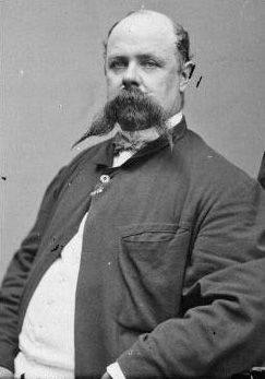
3. Roswell S. Ripley. Roswell Sabine Ripley (March 14, 1823 – March 29, 1887) was an officer in the United States Army during the Mexican-American War and, despite being Northern-born, a brigadier general in the Confederate States Army during the Civil War. He was also an author and a prosperous South Carolina businessman. (Submitted on October 22, 2015, by Brian Scott of Anderson, South Carolina.)
Photographed By Craig Swain
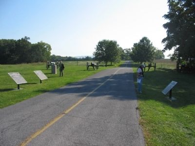
3. War Department Tablets and 1st Maryland Light Position
Federal Tablets 10 (closest, Hartsuff's Brigade) and 9 (Christian's) are on the left side of the road. Tablet 337 for Ripley's Confederates stands on the right. Four 12-pdr Napoleons cover the Maryland state monument for Battery B, 1st Maryland Light Artillery. This point was another of the "hot corners" of the cornfield sector.
Photographed By Craig Swain, February 9, 2008
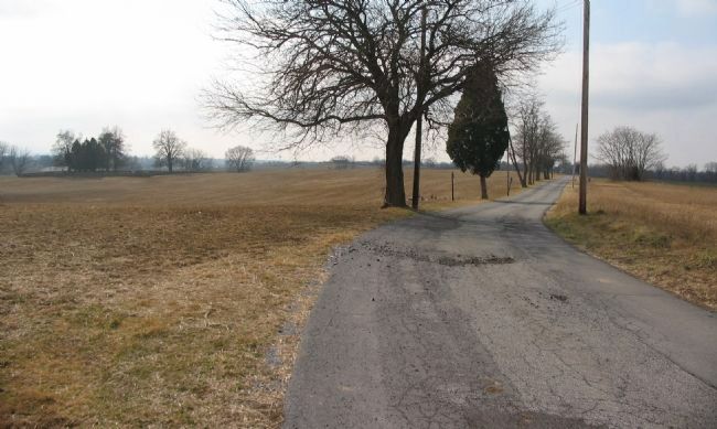
6. Looking at the Mumma's Farm
Looking southwest down the Smoketown Road toward the Mumma's Farm area. The cemetery is seen in the background to the left. At the time of the battle the ground on the left (south) side of the road was field. To the right side was the southernmost edge of the East Woods. Ripley's Brigade moved forward into the Mumma fields, then cut across the edge of the woods to the right. This placed the Brigade on the left flank of Christian's Federal Brigade of Ricketts' Division.

Photographed By Craig Swain, September 17, 2007
7. Confederate Retreat from the Cornfield
Looking south toward the Visitors Center from the marker location. When Greene's Division of the XII Corps crashed through the East Woods, the Confederates defending on the eastern side of the Cornfield fell back through this field to the south of Cornfield Avenue. The ground naturally funnels movement right back to the Dunker Church along the Hagerstown Pike. When the order to fall back was given, Ripley's Brigade was in line of battle along the right side of the photo facing toward the Hagerstown Pike. Thus during the confused fighting the unit that had been the right flank of the Confederate line was defending the left!
Credits. This page was last revised on October 23, 2017. It was originally submitted on February 24, 2008, by Craig Swain of Leesburg, Virginia. This page has been viewed 849 times since then and 21 times this year. Photos: 1. submitted on February 24, 2008, by Craig Swain of Leesburg, Virginia. 2. submitted on October 22, 2015, by Brian Scott of Anderson, South Carolina. 3. submitted on February 24, 2008, by Craig Swain of Leesburg, Virginia. 4, 5. submitted on October 22, 2015, by Brian Scott of Anderson, South Carolina. 6, 7. submitted on February 24, 2008, by Craig Swain of Leesburg, Virginia.
