Barrio Viejo in Tucson in Pima County, Arizona — The American Mountains (Southwest)
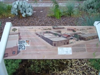
One Story from the Barrio Viejo
The History of Room 6
1914
Room 6 (originally addressed 202 W. 18th Street, and later 709 S. 8th Avenue), on the southeast corner of the excavated row house on Lot 10 (see map), housed several businesses throughout its history. In 1914, it was a blacksmith shop, while around 1919 it became a store and residence.
1951
By 1951, Room 6 was a secondhand shop owned by Bruce and Suzie Draper, who had lived in Tucson since 1929. The Drapers were among the many African Americans who have played an important role in the city's history. They owned and lived at 808 S. 8th Avenue, the next address south of the Lee Lung Company grocery store across the street, and then purchased and moved to Room 6.
1959
For a short time in 1959, Room 6 also served as a studio for radio station KTAN, from which radio pioneer Jacinto Orozco broadcast his show "La Hora Mexicana" (The Mexican Hour). The immensely popular show was the first all-Spanish radio program to be broadcast in southern Arizona. Orozco may have leased Room 6 from the Drapers, who owned the building. He produced the show at other locations in later years.
1960
By 1960, Room 6 had become the location of the De La Corte Bakery. At some time during the 1960s, Room 6, and possibly other rooms attached to it, burned. The collapsing row house had been demolished by 1971.
[Text at upper right of marker]
You are now standing on the site of a blacksmith shop. The archaeological record shows that it was first in operation by 1919 at 616 S. 8th Avenue (now S. Convent Avenue). Records show that a man named M. Pascal operated a blacksmith shop in the row house from 1909 to 1914. It appears that Pascal then moved his shop to this location behind the row house, which remained in operation until at least 1930.
[Text at lower right of marker]
In 2008, archaeologists from Tierra Right of Way Services, Ltd., conducted excavations for the City of Tucson on Lot 10 of Tucson City Block 247, where Mendoza Park now stands. The long history of Lot 10 reflects changing aspects of commerce, ethnicity, and identity within Tucson and the Barrio Viejo community.
Lot 10 was the location of a Sonoran-style adobe row house, a design common throughout the Southwest in times past and testimonial to Tucson's Hispanic heritage. The row house on Lot 10 was constructed in or before 1909, when it appears on a Sanborn fire insurance map. A basic row house typically consists of several rooms on a rectangular floor plan with a slightly sloping roof. Numerous buildings that stand today near Lot 10 follow this plan.
Topics. This historical marker is listed in these topic lists: Hispanic Americans • Settlements & Settlers. A significant historical year for this entry is 1914.
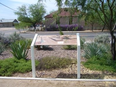
Location. 32° 12.73′ N, 110° 58.31′ W. Marker is in Tucson, Arizona, in Pima County. It is in Barrio Viejo. Marker is at the intersection of West 18th Street and South Convent Avenue, on the right when traveling west on West 18th Street. Marker is on the northwest corner. Touch for map. Marker is at or near this postal address: 750 S Convent Ave, Tucson AZ 85701, United States of America. Touch for directions.
Other nearby markers. At least 8 other markers are within walking distance of this marker. El Parque de Orlando y Diego Mendoza (a few steps from this marker); Temple Emanu-El (approx. 0.2 miles away); Carlos Ygnacio Velasco House (approx. ¼ mile away); Carrillo Intermediate School (approx. ¼ mile away); Teatro Carmen (approx. 0.3 miles away); El Tiradito (approx. 0.3 miles away); Cushing Street (approx. 0.3 miles away); Stone Avenue (approx. 0.4 miles away). Touch for a list and map of all markers in Tucson.
Credits. This page was last revised on June 16, 2016. It was originally submitted on July 24, 2012, by Bill Kirchner of Tucson, Arizona. This page has been viewed 780 times since then and 31 times this year. Photos: 1, 2. submitted on July 24, 2012, by Bill Kirchner of Tucson, Arizona. • Syd Whittle was the editor who published this page.

