Steamboats and Railroads
Looking for Lincoln
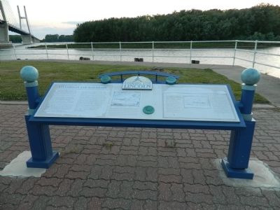
Lincoln traveled to Quincy by stagecoach in 1854 after crossing the Illinois River at Naples. Lincoln's first documented visit was to support the Congressional candidacy of Archibald Williams and to attack the Kansas- Nebraska Act and its author, Stephen A. Douglas. Yet Lincoln and Douglas held similar views on the importance of transportation. As fellow legislators in the 1836-37 Illinois General Assembly, both had included Quincy in bills to promote transportation in Illinois. Both believed Quincy, the state's westernmost community, was the right place for a new railroad hub. Lincoln and Douglas traveled by train to Quincy for the 1858 debate. Illinois' miles of track had nearly doubled during that decade, and both Senate candidates traveled often by rail. Douglas used a lavish private car provided by the Illinois Central Railroad; Lincoln a common coach. The day after the Quincy debate they boarded the City of Louisiana steamboat for their final debate in Alton. Lincoln returned by train to Quincy in 1859, twice headed for Council Bluffs (Iowa), crossing the river by ferry, and once returning from Hannibal after doing legal work for the Illinois Central Railroad.
The Quincy and Chicago Depot at Front and Oak, Quincy's first train station, welcomed the candidates for the Lincoln-Douglas Debate in 1858. Douglas arrived by private train the evening before and Lincoln on the regular Burlington train from Macomb that morning. The railroad line from Chicago to Quincy, later called the CB&Q, had been completed one year earlier. The depot was replaced in 1864 by a new station at Front and Vermont. This sketch is taken from a bird's-eye-view map of Quincy, circa 1859.
Quincy owed its existence to the river. Located on the Mississippi, Quincy had ideal docking conditions for steamboats and soon became a doorway to the West. In 1835 about twenty-five steamboats arrived at the Quincy wharf. By 1841 the number grew to nearly 1,200. Thousands of bushels of corn, potatoes, wheat, oats, beans, and barrels of pork were shipped from Quincy's port. Wheat milled rose from 20,000 bushels in 1835 to 275,000 bushels in 1841. By 1853 Quincy became a port of entry and boats brought foreign goods. The coming of the railroad in 1857 gave farms better access to the river and linked Quincy to the east. The completion of the Quincy and Palmyra Railroad also in 1857 gave Quincy rail access to the west. Commerce and population grew together, and Quincy became the third largest city in Illinois during the 1850's.
Erected by State of Illinois Historic Preservation Agency & Looking for Lincoln Heritage Coalition.
Topics and series. This historical
Location. 39° 56.139′ N, 91° 24.957′ W. Marker is in Quincy, Illinois, in Adams County. Marker is at the intersection of Bonansinga Drive and All American Park on Bonansinga Drive. Touch for map. Marker is at or near this postal address: 401 County Road 523 East, Quincy IL 62301, United States of America. Touch for directions.
Other nearby markers. At least 8 other markers are within walking distance of this marker. Tri-State Business Center (here, next to this marker); The Latter-Day Saints in Quincy (about 300 feet away, measured in a direct line); Ulysses S. Grant (about 500 feet away); Navy Reserve (about 700 feet away); Niemann Building (approx. 0.3 miles away); Limestone Capitals (approx. 0.4 miles away); Lincoln's Friend Johnston (approx. 0.4 miles away); Crockets from Portico (approx. 0.4 miles away). Touch for a list and map of all markers in Quincy.
Credits. This page was last revised on October 8, 2019. It was originally submitted on July 26, 2012, by Bill Pfingsten of Bel Air, Maryland. This page has been viewed 825 times since then and 25 times this year. Photos: 1, 2. submitted on July 26, 2012, by Bill Pfingsten of Bel Air, Maryland.

