Atlantic Highlands in Monmouth County, New Jersey — The American Northeast (Mid-Atlantic)
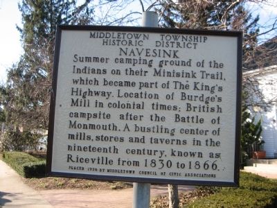
Navesink
Middletown Township Historic District
Erected 1976 by Middletown Council of Civic Associations.
Topics. This historical marker is listed in these topic lists: Colonial Era • Native Americans • Settlements & Settlers • War, US Revolutionary. A significant historical year for this entry is 1830.
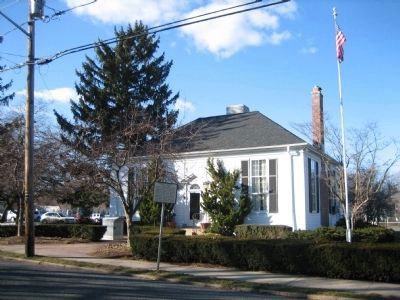
Location. 40° 23.988′ N, 74° 1.812′ W. Marker is in Atlantic Highlands, New Jersey, in Monmouth County. Marker is at the intersection of Monmouth Avenue and Sears Avenue on Monmouth Avenue. Touch for map. Marker is in this post office area: Atlantic Highlands NJ 07716, United States of America. Touch for directions.
Other nearby markers. At least 8 other markers are within 2 miles of this marker, measured as the crow flies. Middletown Township Locust Historic District (approx. 0.3 miles away); British Campsite (approx. 0.3 miles away); a different marker also named British Campsite (approx. half a mile away); a different marker also named British Campsite (approx. 0.7 miles away); The Hartshorne Legacy (approx. 0.9 miles away); Henry Hudson Springs (approx. 1.1 miles away); Highest Point on the Atlantic Seaboard (approx. 1.4 miles away); Friends of Monmouth County 9/11 Memorial (approx. 1.4 miles away). Touch for a list and map of all markers in Atlantic Highlands.
Related markers. Click here for a list of markers that are related to this marker.
Additional keywords. Atlantic Highlands Middletown Library NJ Navesink
Credits. This page was last revised on May 3, 2018. It was originally submitted on February 28, 2008, by David Anderson of Middletown, New Jersey. This page has been viewed 2,078 times since then and 50 times this year. Last updated on April 27, 2018, by @histkeep of Middletown, New Jersey. Photos: 1, 2. submitted on February 28, 2008, by David Anderson of Middletown, New Jersey. • Andrew Ruppenstein was the editor who published this page.

